
The Ridge Historical Society
Native American Heritage Month
By Carol Flynn
November is Native American Heritage Month, declared by President George H.W. Bush in 1990.
According to the government website for the day, the intent is “to provide a platform for Native people in the USA to share their culture, traditions, music, crafts, dance, and ways and concepts of life.”
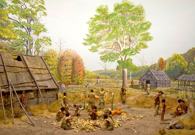
Native Americans once thrived in the Blue Island area. Research by the Illinois State Archeological Survey team, which operates out of the University of Illinois – Champaign/Urbana campus, has identified over 600 Native American sites in the surrounding forest preserves, some dating back thousands of years.
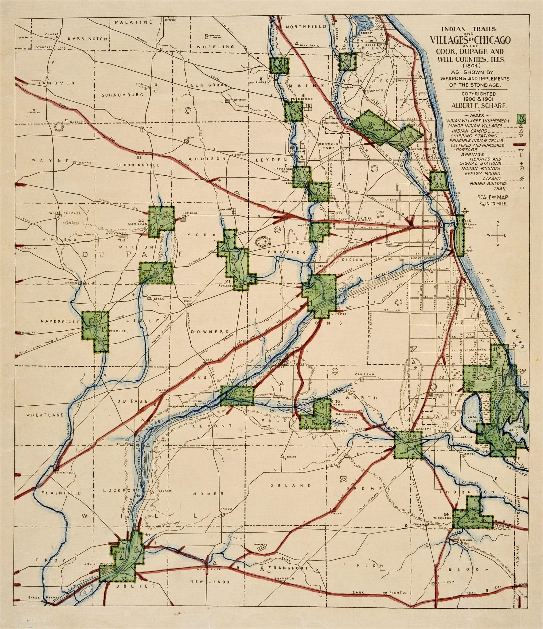
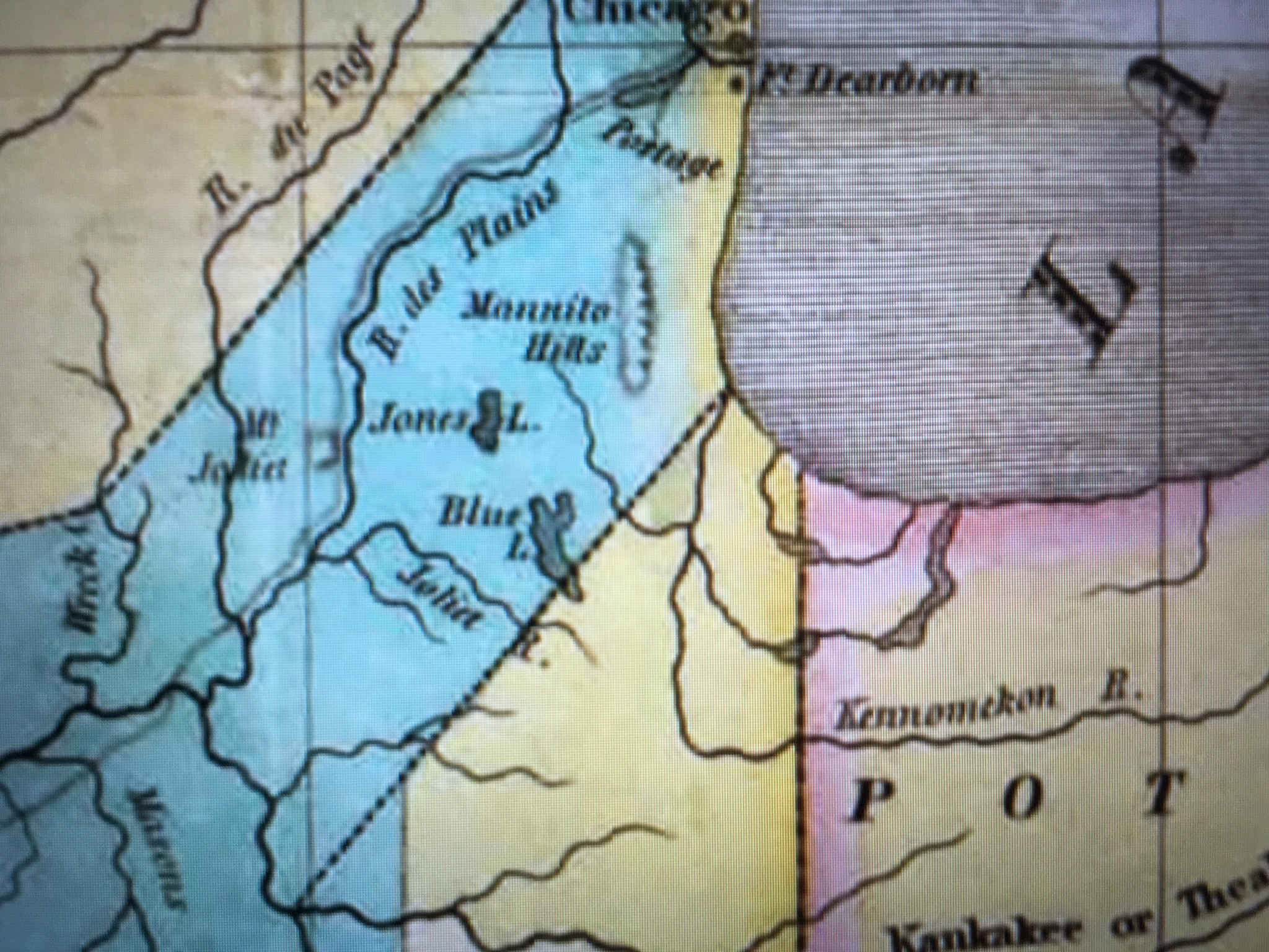
A map from the 1800s, referred to as the Scharf map, attached, shows villages, burial sites, signal stations, and other Native American locations from around 1804. There were locations along the Calumet River system, which connected to the Stony Creek, before the Cal-Sag Channel was built.
There was a village in the southern part of the city of Blue Island, around Vermont Street just east of Western Avenue, and burial grounds nearby. The northern tip of the Blue Island Ridge, located just north of 87th Street in Dan Ryan Woods, was the location of a “signal station,” which is not surprising, given its high elevation and clear view all the way to downtown Chicago.
There were no villages on the Ridge, however, and this could be because the local Native Americans considered the location to have sacred significance. Another map identifies the Blue Island Ridge with the term “manitou” which indicated a spirit presence. Humans all have personal manitous, and they were also ascribed to significant natural places.
There was the Vincennes Trail, an early animal path that the Native Americans turned into a trail that was then used by fur traders and settlers. It originally cut across the top of the Ridge, but Thomas Morgan had it rerouted to below the Ridge on the east side so it would not cross his property, once the U.S. government sold off the land to settlers.
There was another Indian trail that ran along 103rd Street on an angle, from the southwest to the northeast.
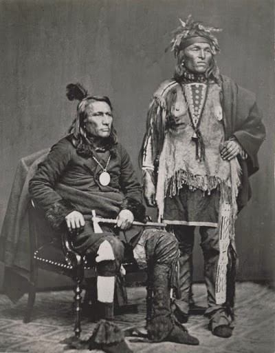
With the Treaty of Chicago in the 1830s, most of the Native Americans, by then primarily part of the Potawatomie nation, left Chicago.
However, they had left the Ridge area some years before that, after the War of 1812.
After U.S. military and settlers were killed, and Fort Dearborn was burned down, by Potawatomi warriors in the Battle of Fort Dearborn, the U.S. government became determined to remove Indians from the area to allow further settlement to go on unimpeded. “Chicago” was strategically located for transportation and trade, and the land surrounding it was rich for farmland.
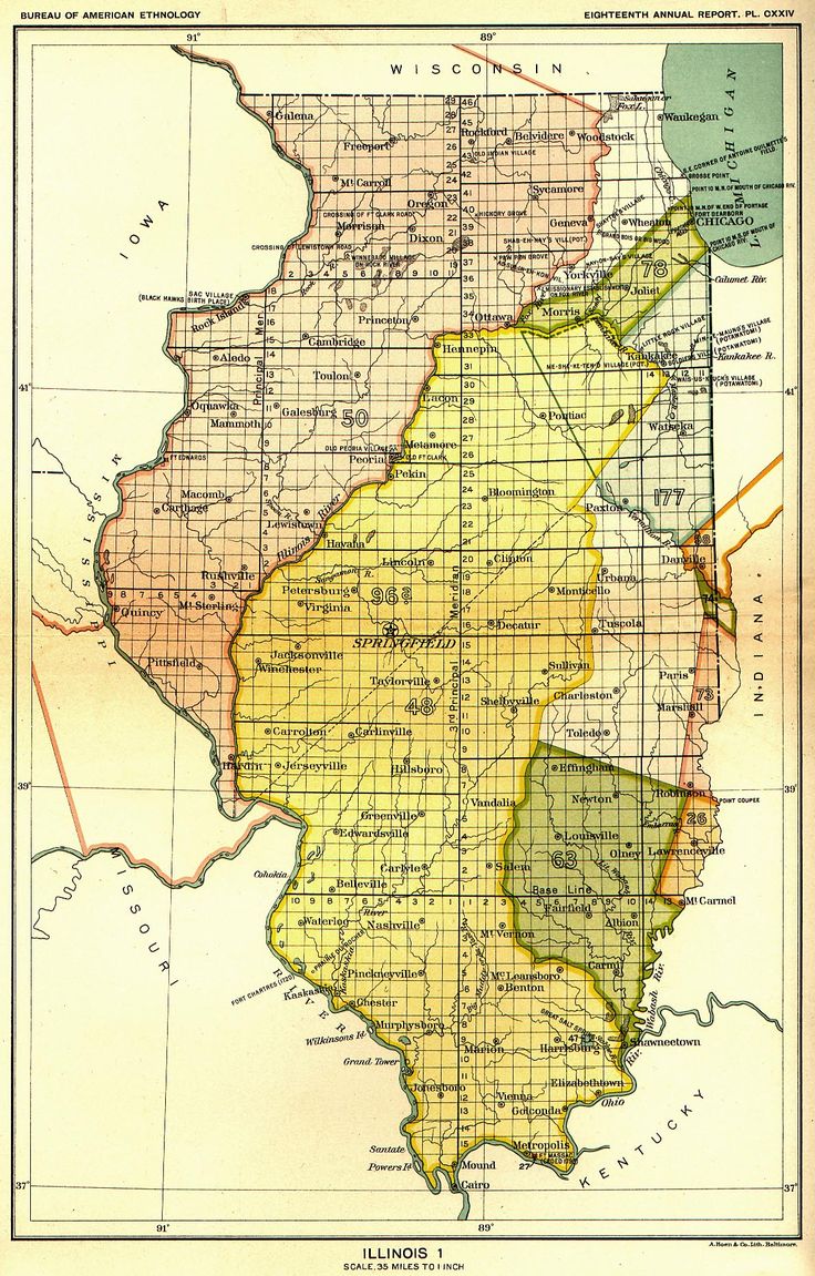
Fort Dearborn was rebuilt in 1816, and a treaty with the Council of Three Fires (the Ojibwa, Odawa, and Potawatomi, although only the Potawatomi were living in the Chicago area) was signed. In this treaty, called the Treaty of St. Louis, the Indians gave up all claims to a 20-mile strip of land that included the Chicago Portage connecting Lake Michigan to the Illinois River. The Chicago Sanitary and Ship Canal is on this land now.
“Indian boundary lines” which started at the lake and ran southwest were established on either side of this strip of land (see attached map). The deal with the Indians was that white settlers were permitted to settle safely within the lines. The southern line ran just below the southern tip of the Blue Island Ridge, placing the lands of the Ridge communities, that is, today’s communities of Beverly Hills, Morgan Park, Washington Heights, and Mount Greenwood, and the City of Blue Island, within the settlers’ territory.
Although the “Illinois Territory” was first claimed for the developing U.S. during the Revolutionary War, this made it official that the Blue Island Ridge was under the control of the U.S. government, slated for settlement by U.S. citizens, and was no longer under the control of Native Americans.
Other treaties followed, in 1821, and following the Black Hawk War in 1832. With the 1833 Treaty of Chicago, the U.S. government took over total control of certain Native American lands west of Lake Michigan, including the Chicago area. The Potawatomi received promises of cash payments and tracts of land west of the Mississippi River.
In 1835, five hundred Potawatomi warriors gathered in full dress and danced the last recorded war dance in the Chicago area.
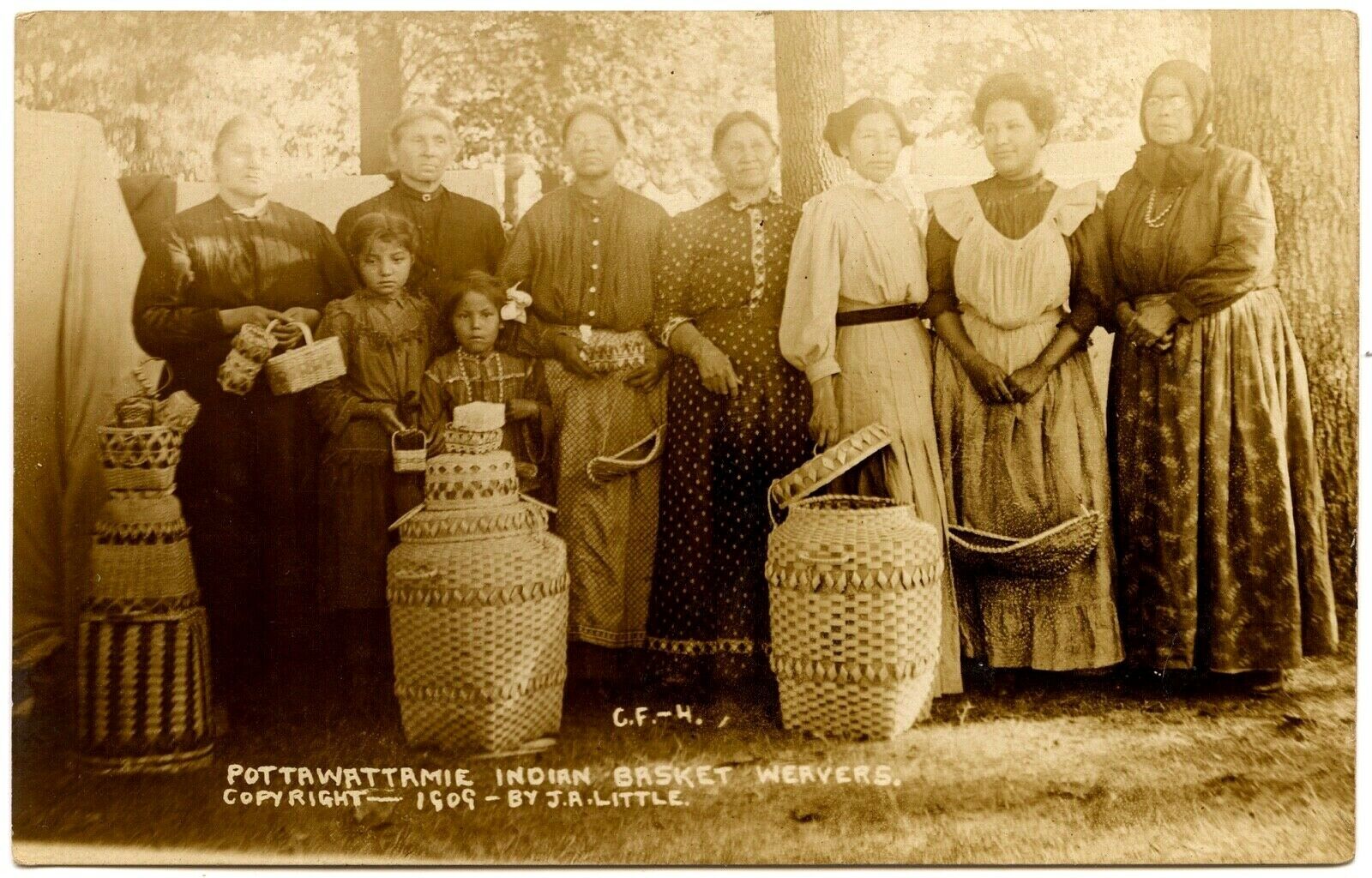
Most of the Indians left the area after that. Chicago was incorporated as a city in 1837. But for many decades, some Native Americans stayed in the area, and some continued to return to their summer ancestral grounds along the Calumet River.
Early white settlers found and recorded many Native American artifacts in the area. Postholes were reported to be found in the 1840s at what is now the east side of Hale Avenue, between 104th and 105th Streets, and stone tools were found in the area.
The Barnard family reportedly collected 36 flint arrowheads, two battle axes, a spearhead, and several pieces of ancient pottery. They reported finding “the remnants of pottery in a small mound surrounded by large cobble-stones and embraced within the roots of a small oak tree which sprang up from the mound.” The location or importance of this mound were not identified.
Today, there is almost no representation of Native Americans in the area. A reported 65,000 Native Americans representing 175 tribes live in the greater metropolitan area of Chicago. The majority lives on the North Side, and the U.S. Censuses report less than 1% of the population around the Ridge is Native American. Some people do come forward, though, and report mixed ancestry.