
The Ridge Historical Society
The History of The City Wards in The Ridge Communities – Part I: The Current Picture
By Carol Flynn
As we wrap up one series, the Native Americans on the Ridge, we will also start a new one on the history of the city wards on the Ridge. This series will not be posted on other pages – readers who are interested in this topic are encouraged to follow the Ridge Historical Society page.
“Redistricting” is one of the hot topics in Chicago politics right now, so it’s the perfect time to look at the history of the city ward system in relationship to the neighborhoods that RHS covers. We will start with a review of the situation as it stands today.
The City of Chicago is divided into 50 legislative units called wards. The voters in each ward elect an alderman every four years to represent them on the Chicago City Council, the legislative branch of the city government. The presiding officer of the Chicago City Council is the Mayor, currently Lori E. Lightfoot, and the City Clerk of Chicago, currently Anna M. Valencia, is the secretary. The aldermen elect a President Pro Tempore from within their ranks to serve in the absence of the Mayor. This position is currently held by Brendan Reilly, the alderman of the 42nd ward.
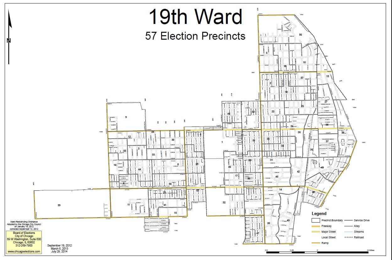
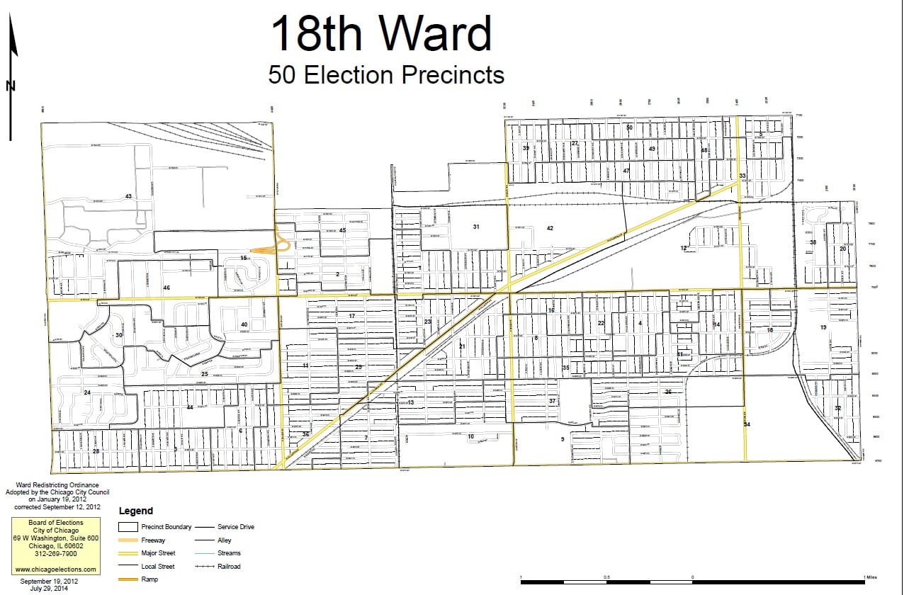
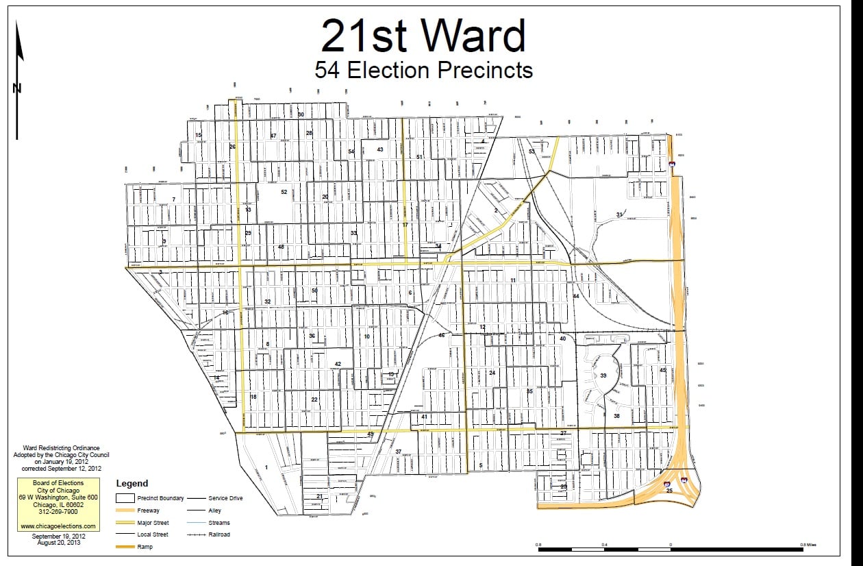
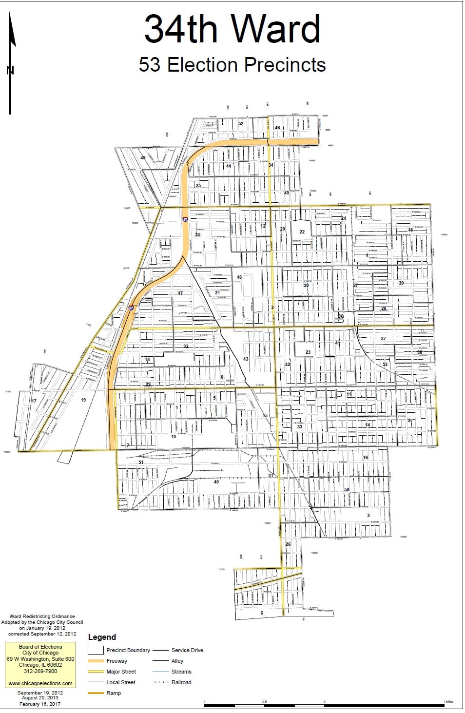
The historical communities represented by the Ridge Historical Society, that is, Washington Heights, Beverly Hills, Morgan Park, and Mount Greenwood, currently fall into four wards – 18 (Derrick G. Curtis, alderman), 19 (Matthew O’Shea, alderman), 21 (Howard Bookins, Jr., alderman), and 34 (Carrie M. Austin, alderman). All of these aldermen are up for re-election in 2023.
Establishing wards and deciding their boundaries have always been intense political exercises in Chicago. The City redraws the ward map every ten years based on population changes reported in the U.S. Census. The goal is to have fifty wards of roughly the same number of residents. Ward boundaries are different from “neighborhood” boundaries, police districts, school districts, etc. All of these geographical – really, geopolitical – divisions are arrived at separately.
If 41 of the 50 aldermen approve a new ward map by an official vote of the City Council, then there is no public referendum on the issue. If no map gets this required support, then voters decide between competing proposals.
Next post: The Origins of The Ward System