
We are going to switch up things a little bit. We are starting a series on the history of Dan Ryan Woods, and we will still continue to run the profiles on people for whom public schools on the Ridge are named.
The history of Dan Ryan Woods – Part 1: The woods become part of the forest preserves
By Carol Flynn
On November 10, 1916, a small article in the Chicago Daily Tribune reported that the Cook County forest preserve board would have a walk through the woods at Beverly Hills that day, with an eye toward purchasing them. That visit surely went well, because in September 1917, for the price of $152,937, the forest preserves district purchased 112.88 acres from the estate of John B. Sherman. The area was roughly bordered by Western Avenue, 83rd Street, the Rock Island railroad tracks and 89th Street.
The following year, the Forest Preserves of Cook County (FPPC) issued a report that enthusiastically praised the Beverly Hills Preserve. Peter Reinberg was President of the Cook County Board of Commissioners at the time, and the board also had responsibility for the forest preserves. Daniel Ryan was on the Board and was Chairman of the Finance Committee and Chairman of the Depositories Committee, and a member of the Real Estate, Plan, and Forestry and Improvement Committees.
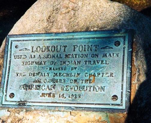
The 1918 report stated that the location had long been recognized as a historical attraction because of the towering bluff “Indian warriors utilized as a look-out and signal station in the days when they were fighting to hold their homes against the invading white men.”
This version of the early history of the land recounted the tale of the signal station atop the “Beverly Bluff” bursting into flame with the bonfires of the Indians, which produced ribbons of smoke that warned tribes for miles around.
Of course, as colorful as this story is, it is largely folklore. Without any doubt the Native Americans knew the northern tip of the landmass the white settlers called the Blue Island. There were Indian villages along the Calumet River at the southern end of the island and settlers found many Indian artifacts around the Ridge. Standing on the bluff, one could see all the way to Fort Dearborn, about 12 miles to the northeast. The fort was located about where the Michigan Avenue bridge is today, where the Chicago River joins with Lake Michigan (333 N. Michigan Ave,).
For some time, white trappers and traders had been following the Vincennes Trail through the prairies and wetlands and oak savannas of the Blue Island Ridge area. This trail was first worn by animals keeping to the high ground, then used by Native Americans. It ran south from Chicago, then east to Vincennes, Indiana.
Settlement of the Blue Island area by white families was gradual. By the time they began to put down roots here in earnest in the 1830s, the Native Americans in this area were almost all gone, due to the federal Indian Removal Act of 1830. The Treaty of Chicago in 1833 led to the final withdrawal of the Potawatomi, Chippewa, and Ottawa tribes from the Lake Michigan area.
Native Americans were still spotted in the area for decades afterwards. Although there was some fear and mistrust of them on the part of some of the white settlers, there were no large scale hostilities reported in the early histories. One early settler wrote about riding his pony as a boy across the prairies with the local Indians.
In 1922, the Dewalt Mechlin Chapter of the Daughters of the American Revolution placed a marker in the woods along the north side of 87th Street to commemorate the Indian lore that earned the bluff the name “Lookout Point.” That marker should still be there. [Note: It has since been reported that this plaque went missing 2-3 years ago. Pictures are all that remain.]
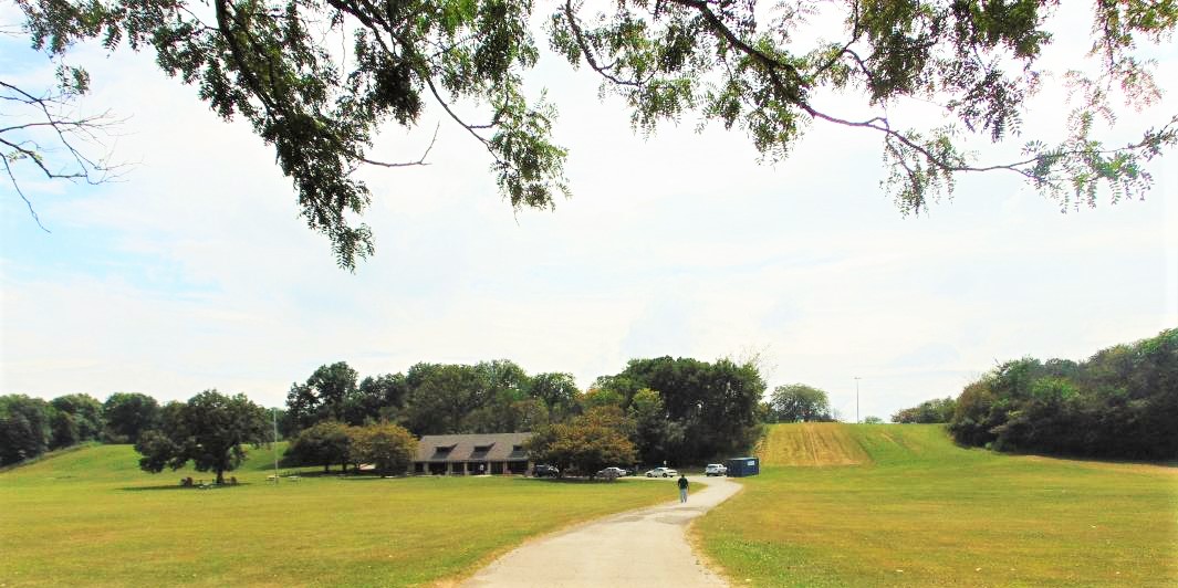
The 1918 report was full of praise for the Beverly woods, stating, “In Beverly Hills, the southern end of Cook County has a real beauty spot. It is a preserve only 126 acres in extent but for its acreage it boasts more spectacular points of interest than any other stretch of forest land in the county. It is an ideal natural park.”
The report also pointed out that the Beverly preserve had the distinction of being the only one accessible to all of Chicago “on a five cent fare.” Visitors could take the Ashland Avenue streetcar to 87th Street and walk west to the Ridge. Another option was to take the Rock Island train from the LaSalle Street station to the Beverly Hills station at 91st Street.
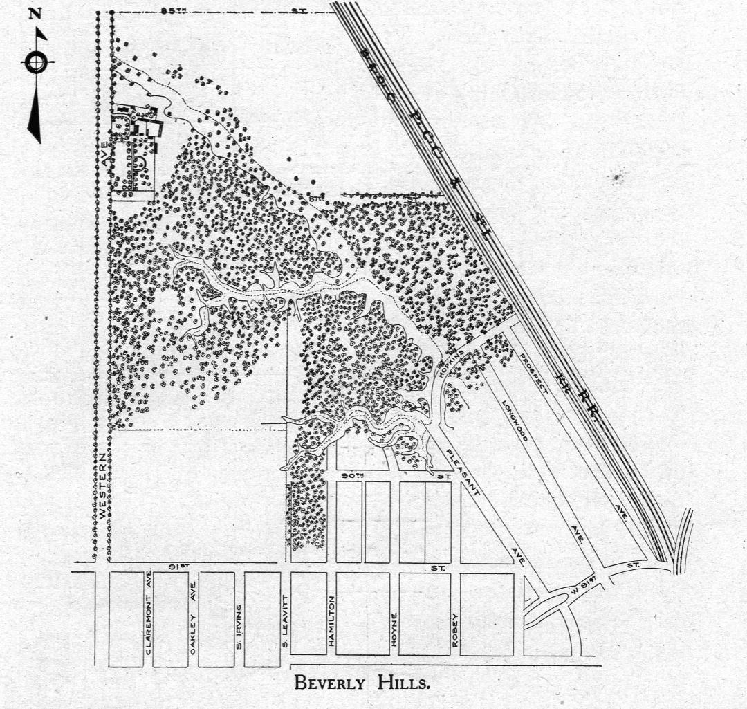
The 1918 report included a map of the woods as they were at the time they became part of the forest preserves. The map includes structures that likely dated back to the days when the land was the Sherman Farm, filled with “splendid herds of stock.”
The next installment will look at the formation of the forest preserves, and the “Sherman Farm at Forest Hill.”