
A history discussion is going on in another Facebook page so I am going to share the information I am posting there. The original poster was confused about Chicago wards, neighborhoods, school districts, police districts – they don't match up. The answer is no, they don't because all these systems were developed independently of each other and each system determines its own boundaries. Add in fire districts, postal districts, zip codes, state and federal representative districts, etc., and there are a lot of "boundaries" to keep straight.
On my to-do list is a history of the 19th ward. I'll do that before the next election.
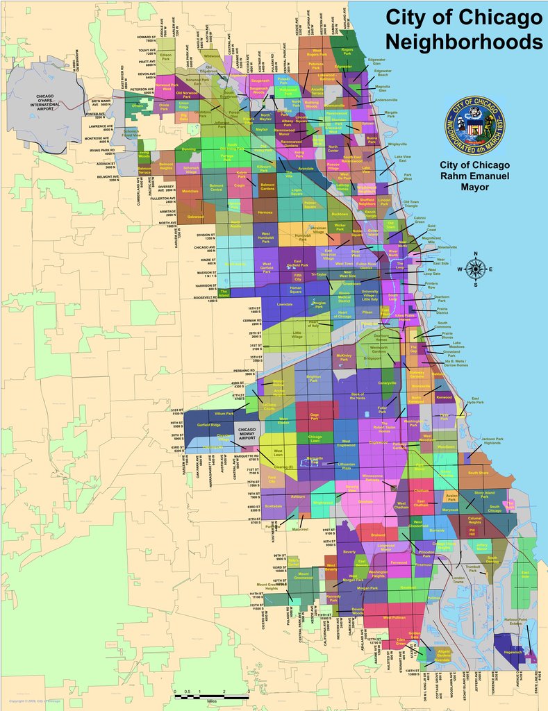
But today I want to share about "neighborhoods." Neighborhood names like Beverly Hills, Morgan Park, Englewood, Ravenswood, Norwood Park, etc., really do not have any "legal" status. They are mostly historical and cultural remnants of villages and towns that were annexed to the city of Chicago through the years. They all have "boundaries" that were legal when they were their own municipalities but that stopped meaning anything when they joined Chicago and the land was assigned to a ward. So today, a "neighborhood" like Morgan Park or Englewood can be in several wards and police districts and school districts, etc. The "neighborhood" has nothing to do with the various districts.
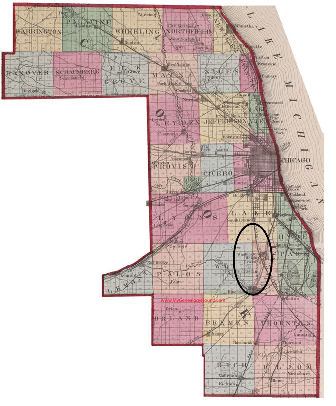
The counties in the state of Illinois were once divided into "townships." Attached is a map of Cook County from 1870, showing the townships. The "Ridge" area is in the circle. Parts were in three townships – Lake, Calumet and Worth. In 1889, all of Lake Township voted to join the city so a big chunk of the northern Ridge became part of the city effective in 1890. Most of today's Beverly was included.
The townships were dissolved in 1902 in Chicago, but they are still used today for taxation purposes. Once dissolved, each municipality was on its own. Morgan Park annexed to the city in 1914, Mount Greenwood in the 1920s. Blue Island and Evergreen Park voted to not annex to the city so that is why the boundaries here on the SW side look the way they do for the city of Chicago.
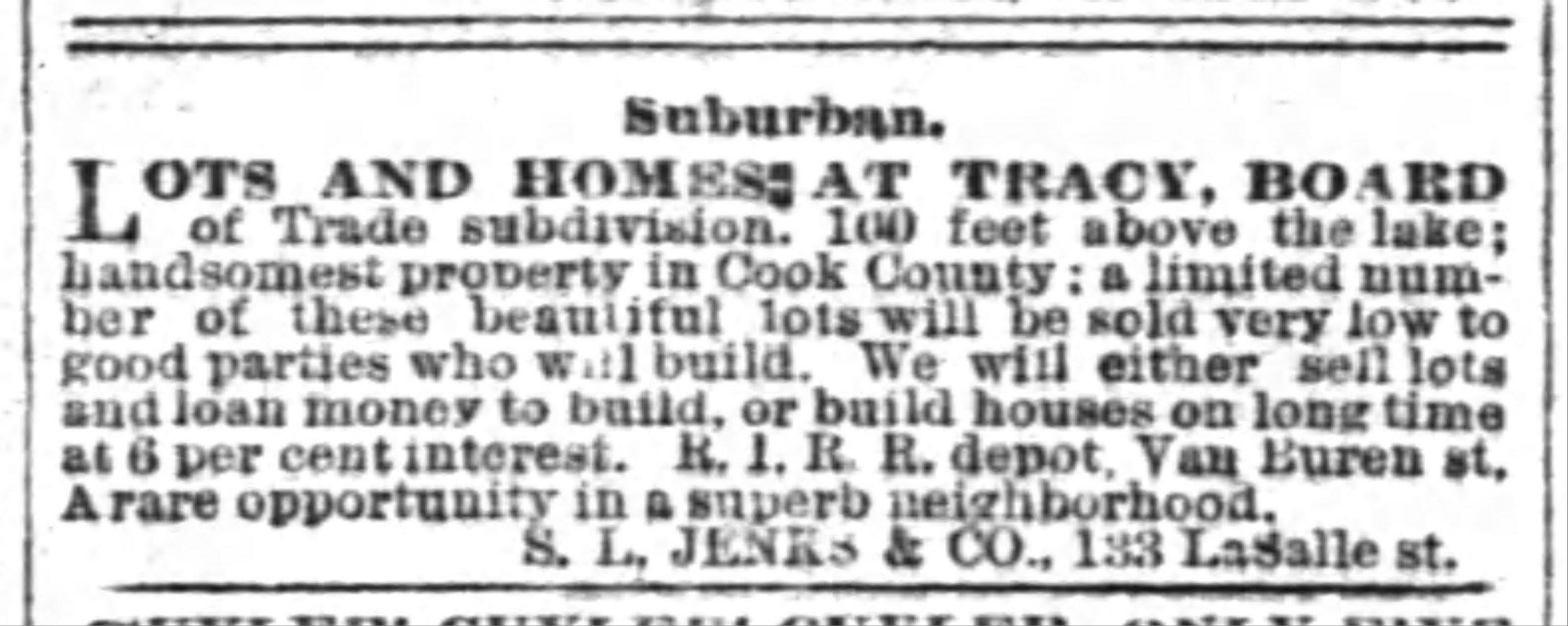
In addition, neighborhoods were, and still are, often divided up further for commercial and real estate purposes. For example, the area round 103rd Street and Longwood Drive was called "Tracy" for a number of years because 103rd Street was originally called Tracy and there was substantial real estate development in the area. An 1885 ad showing this is attached. Last, a current "neighborhood" map of the area from the city is included, with all the little sub-divisions, mainly used for positioning real estate.