Presents ‘then-and-now’ aerial photos of 103rd Street and Longwood Drive, comparing 1899 kite photography with modern drone images
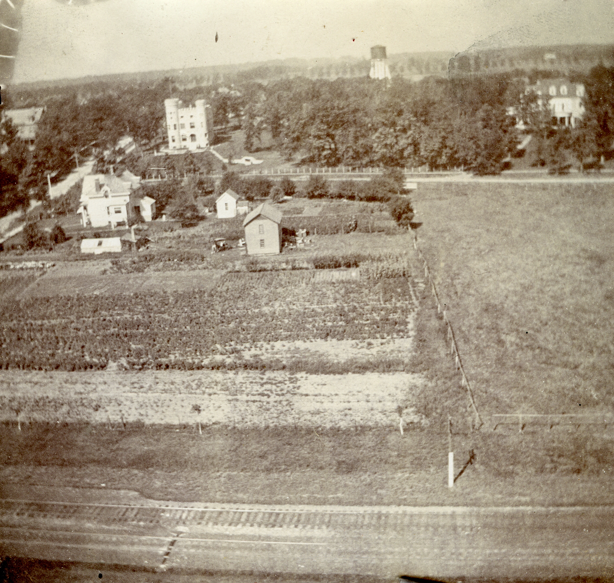
1899 aerial photo by Murray and Cox that appeared in the Chicago Sunday Times Herald.
Easily identified in the upper left of the photo is the Robert C. Givins House also known as the Givins Beverly Castle. To the north is the Horace E. Horton House at 10200 Longwood Drive built in 1890 for the founder of the Chicago Bridge & Iron Company. These two landmarks are still here today.
Also in the photo are structures long gone. Across the street to the east of the Castle was the Barnard seed farm. The Barnards, early settlers in the area, grew primarily flowers which they harvested for the seeds and sold on the retail market.
In the upper middle background is the Washington Heights water tower, which was located between Hoyne and Seeley Avenues. Since the area had been annexed to the City of Chicago in 1890, water from local artesian wells had been replaced by water pumped up to the Ridge from Lake Michigan. This was one of the pumping stations and storage tanks for the “city water.”2024 photo by Benjamin Johnson, Airborne Brothers, LLC.
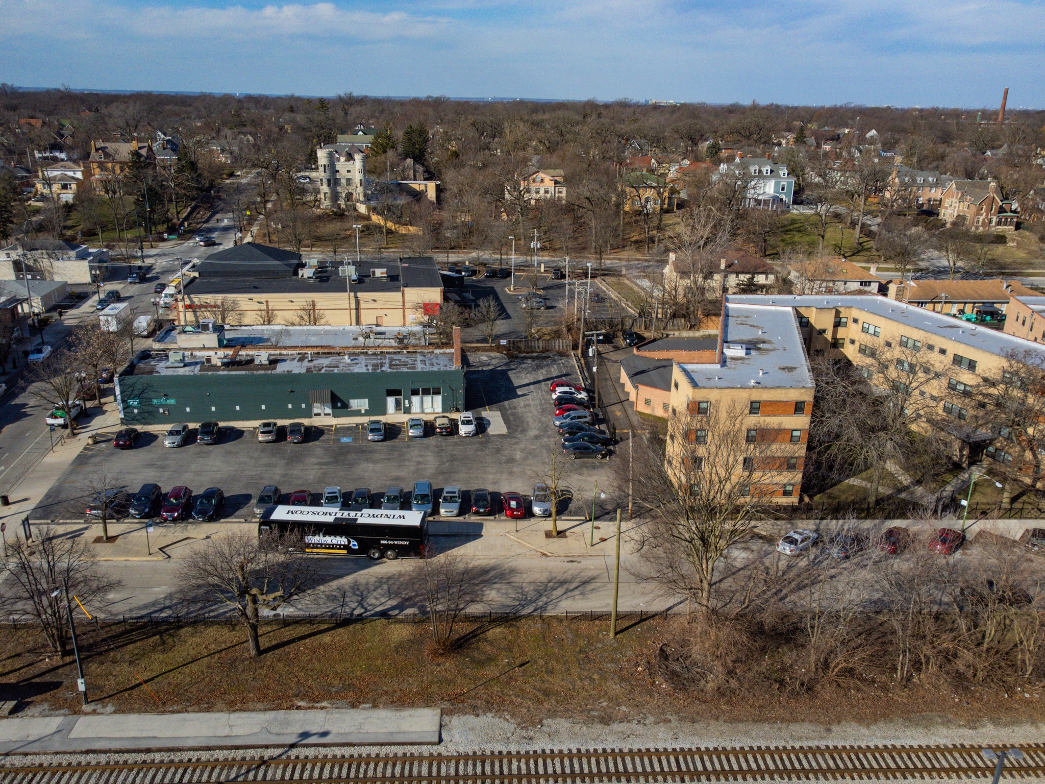
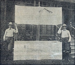
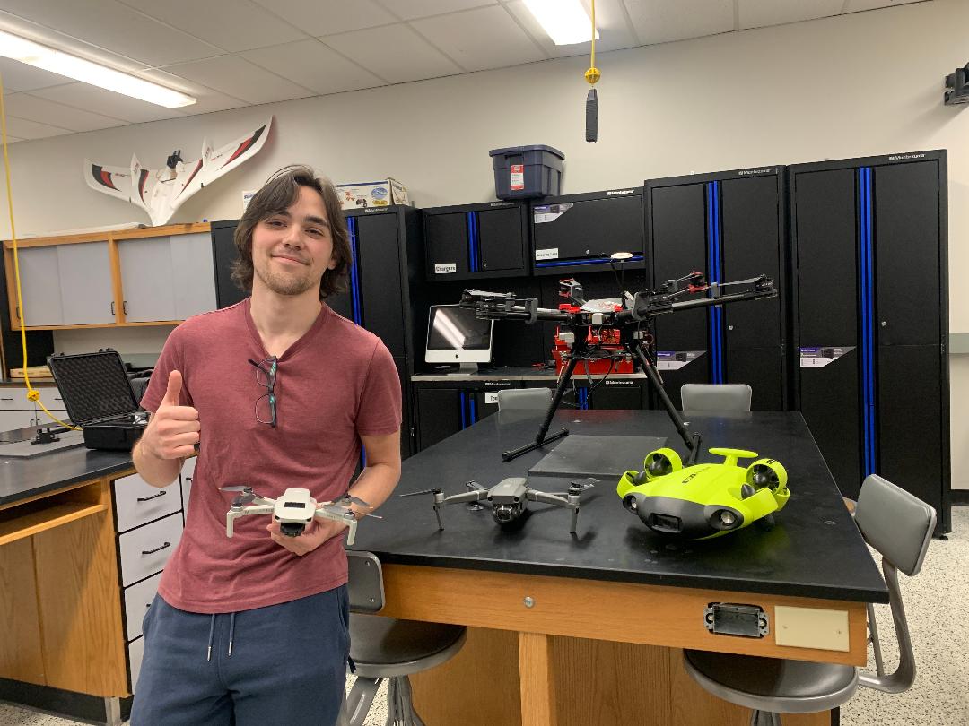
The photo reveals an area much more developed. The Castle and the Horton house are still there, but long gone is the Barnard farm, replaced by the CVS pharmacy and the Beverly Bank. The water tower is gone, and the remnants of the site are covered by the backyards of the houses built along Hoyne and Seeley Avenues.Robert Heffron Murray and Frank Cox pose with their large box kite, from the Chicago Sunday Times-Herald, September 17, 1899.Benjamin Johnson holding his drone in Lewis University’s drone flight lab, waiting for class to start. The other drones belong to Lewis University and Johnson has operated them as a student. Photo from B. Johnson.
The Ridge Historical Society
More on Aerial Photography
By Carol Flynn
The current Ridge Historical Society (RHS) exhibit, “Louise Barwick’s Lost Ridge,” includes aerial photographs taken in 1899 by young men who attached a camera to a kite and sent it soaring over the community.
As covered in this article in the Beverly Review, in February, a college student from Morgan Park, Ben Johnson, took photos of those same views using drone technology:
Here we present the “then-and-now” photos of the area surrounding the corner of 103rd Street and Longwood Drive, as well as images of the photographers.
For more information on the topic, visit the RHS exhibit on Tuesday and Sunday afternoons from 1:00 to 4:00 p.m. RHS is located at 10621 S. Seeley Avenue.