
Explore the RHS Facebook Archives, a rich repository of local history written by Carol Flynn. For two decades, Carol brought a deeply dedicated voice to public education at RHS. Her role as Facebook administrator through mid-2025 naturally extended her prolific research into meticulously detailed articles, most notably her multi-part historical series posts. Today, Carol continues her local history writing for The Beverly Review and other outlets.
Native American Heritage
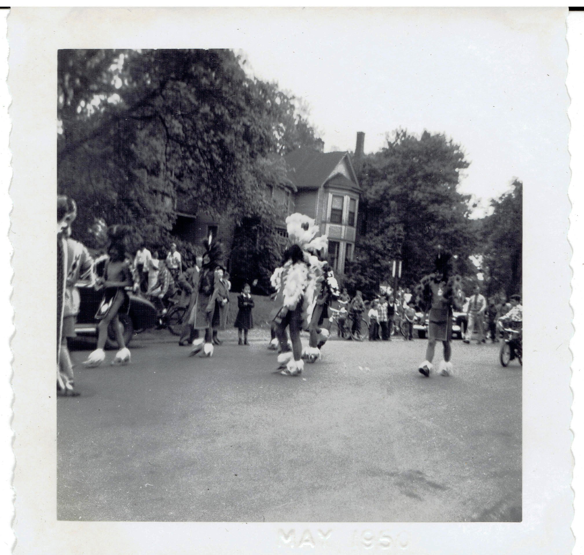
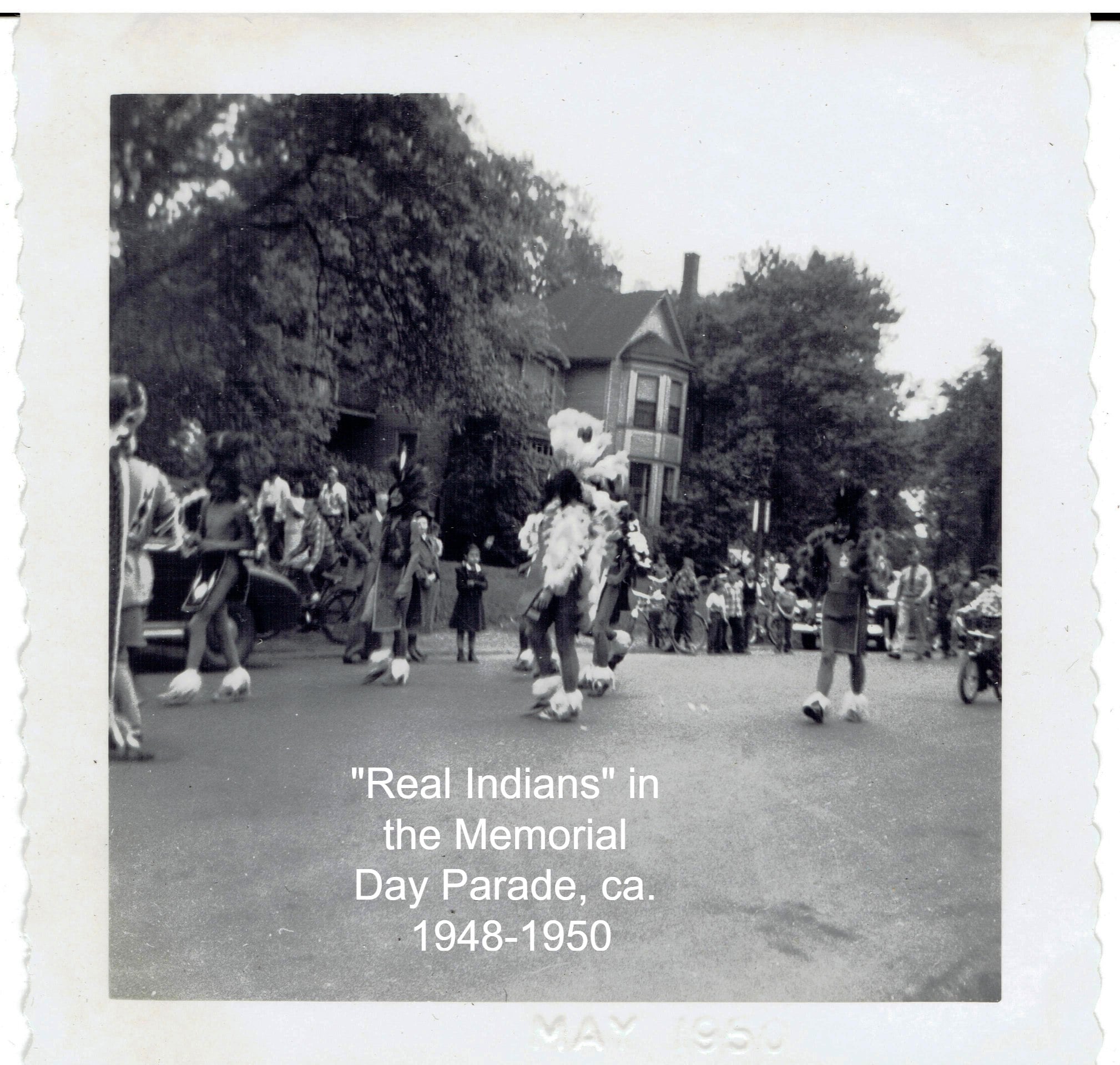
There is a new post in our other, interactive page – Beverly/Morgan Park/Washington Heights History. Check it out! Join that page! We are looking for information on this intriguing picture that was labeled "Real Indians" in a photo album from ca. 1948-50. They were marching in the Memorial Day Parade on Longwood Drive.
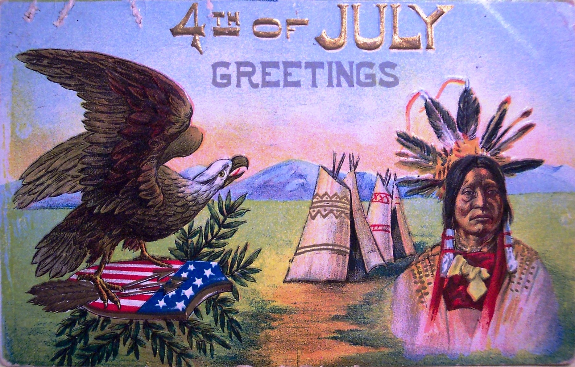
Vintage postcards for the 4th of July. These are a little different so they are of particular interest. The first one uses a depiction of a Native American to celebrate the holiday, which seems curious because Native American issues are rarely considered in discussing the English colonists' rebellion against the crown. The intent seems to be the preservation of the legacy of the original land, but we all know how that turned out for the Native Americans.
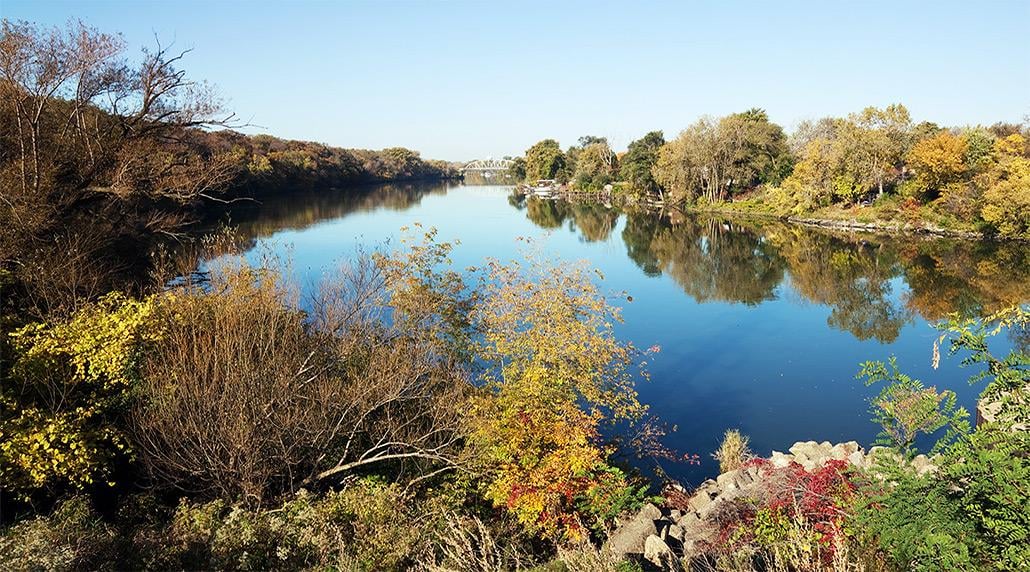
As far as the history of the Ridge goes, there was a strong historic presence of Native Americans in the area, especially along the Calumet River. Archaeological excavations are currently going on in local forest preserves. But the Treaty of Chicago in 1833 led to the withdrawal of the remaining Potowatomi to west of the Mississippi River.
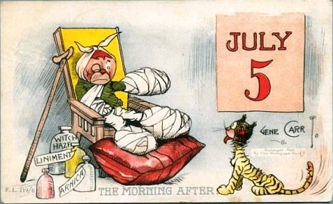
The second postcard is actually for July 5, the day after the holiday. It shows a child and pet recovering from fire cracker injuries. While this might have had a humorous intent, it also serves as a warning to be very careful with home fireworks displays.
The First Thanksgiving Feast
Thanksgiving Day is a uniquely American holiday, and more so than any other holiday, is associated with a “traditional” menu – turkey, bread stuffing, mashed potatoes and gravy, sweet potatoes, cranberry jelly and pumpkin pie are the normal fare. But some of these items were certainly NOT on the menu for the first celebration of the settlers who gave us the original reason to be thankful.
The first “Thanksgiving” celebration recorded in American history occurred in 1621 in Plymouth, Massachusetts, as a harvest feast. Note that there was already a colony of settlers in Virginia, those who came to Jamestown in 1607 and after. They certainly also had harvest celebrations, but they were not well recorded.
The celebrants of the 1621 feast were the English Protestants, called Puritans, and forever after known affectionately in American history as the Pilgrims, who had split from the Church of England and come to the New World on the Mayflower the year before; other Englishmen who also came on the boat; and the Wampanoag people, the Native American tribe that had lived in the area for over 12,000 years.
The Pilgrims got off to a bad start in the New World. Delayed in leaving England, they arrived just in time for winter and spent the first year on the ship in Plymouth harbor. About half of the original 150+ settlers and crew died that first winter.
But the second year, in March, they finally left the ship and built some huts. Early relations between Native Americans and the European settlers were very cordial. The Wampanoag showed the Pilgrims how to fish and hunt in the area, and how to cultivate the native food plants and gather fruit.
Some items we take for granted now were not around 400 years ago. For starters, there were no sweet or white potatoes. Potatoes did not come up to North America from South America for another 100 years. Also, the Pilgrims had not yet planted wheat fields so there were no pies and no bread. The sugar rations and almost all the food they brought with them had quickly been depleted on the journey over, so there were no jellies or sweet desserts to be made. The Pilgrims had brought no large livestock with them on the Mayflower, only chickens, and a few pigs and goats, so there were no dairy products except maybe goats’ milk. Dairy cows would come later. Plus, no ovens had been constructed yet for baking, so all cooking was done over open fires.
An early journal has the colonists going fowl hunting for this harvest feast. Duck, geese, swans and turkeys were all plentiful. The Wampanoag guests brought an offering of five deer to the celebration, so venison, probably some roasted and some served in a hearty stew, was without doubt on the menu. Historians also believe that seafood was a major component of the feast, this being New England by the coast. Mussels, lobster, bass, clams and oysters were readily available. The first Thanksgiving was very heavy on animal protein. And actually, completely gluten-free.
The vegetables cultivated at the time included corn, pumpkins, squash, turnips, garlic, onions, beans, carrots, lettuce, spinach and cabbage. The pumpkins would have been roasted. Fruits available for gathering included blueberries, plums, grapes and gooseberries. Cranberries were there but it was another 50 years before there were reports of boiling them with sugar to make a jelly.
Flint corn, the multi-colored Indian corn, was plentiful at the first harvest. Most likely, the corn was turned into cornmeal, which was boiled and pounded into a thick corn mush or porridge that was occasionally sweetened with molasses, which was made from sugar cane, which came from the Caribbean. This was called Indian pudding, a take on the English fondness for “hasty pudding.”
Herbs, and nuts like chestnuts, walnuts and beechnuts, were plentiful from the forests. Along with onion, these would have been used for stuffing the fowl and flavoring dishes.
The celebration itself was a three-day event, with feasting, ball games, singing and dancing. Assumedly, grace was said before meals, but it was several years later that an official prayer service was added to the annual harvest celebration to give thanks for rain after a two-month drought.
Within years, other settlers came, with cows and then there was milk. They planted wheat and other crops, and eventually their diet expanded.
Fast forward to 1827, and Sarah Josepha Hale, editor of the popular Godey’s Lady’s Book, began advocating for a national Thanksgiving Day. She petitioned 13 presidents until finally Abraham Lincoln made the declaration in 1863 as a way to help unite the country in the midst of the Civil War.
For decades, Hale published Thanksgiving recipes and menus in her magazine. She also published a number of cookbooks. She championed mashed potato dishes, which were still considered exotic in the mid-1800s.
A typical cookbook of 1870 recommends the following for Thanksgiving dinner: Oyster soup; cod with egg sauce; lobster salad; roast turkey with cranberry sauce; mixed pickles; mangoes; pickled peaches; cold slaw and celery; boiled ham; chicken pie ornamented; jelly; mashed potatoes browned; tomatoes; boiled onions; canned corn; sweet potatoes; roasted broccoli. Mince and pumpkin pie; apple tarts; Indian pudding. Apples, nuts, and raisins.
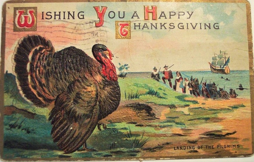
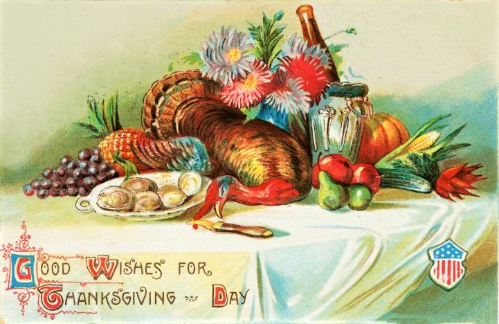
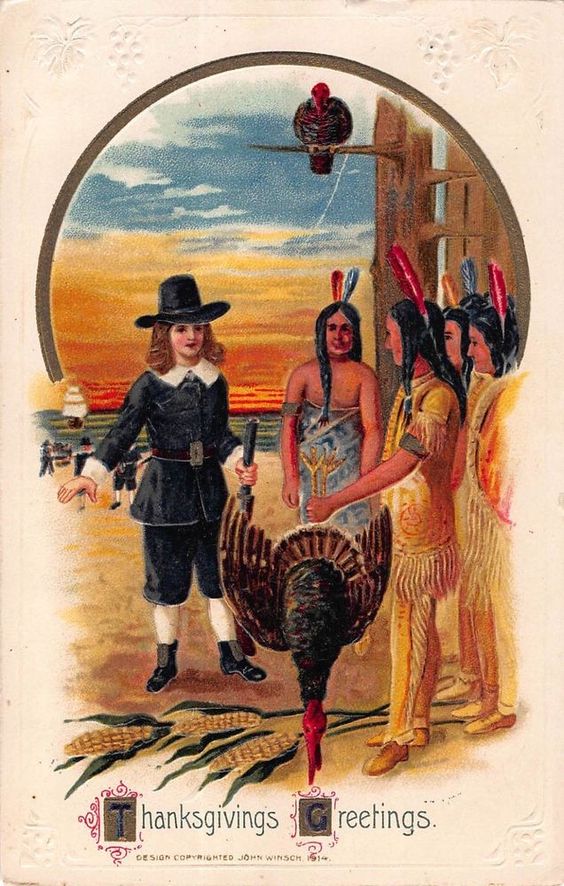
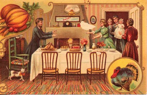
Some vintage Thanksgiving postcards ….
We are going to switch up things a little bit. We are starting a series on the history of Dan Ryan Woods, and we will still continue to run the profiles on people for whom public schools on the Ridge are named.
The history of Dan Ryan Woods – Part 1: The woods become part of the forest preserves
By Carol Flynn
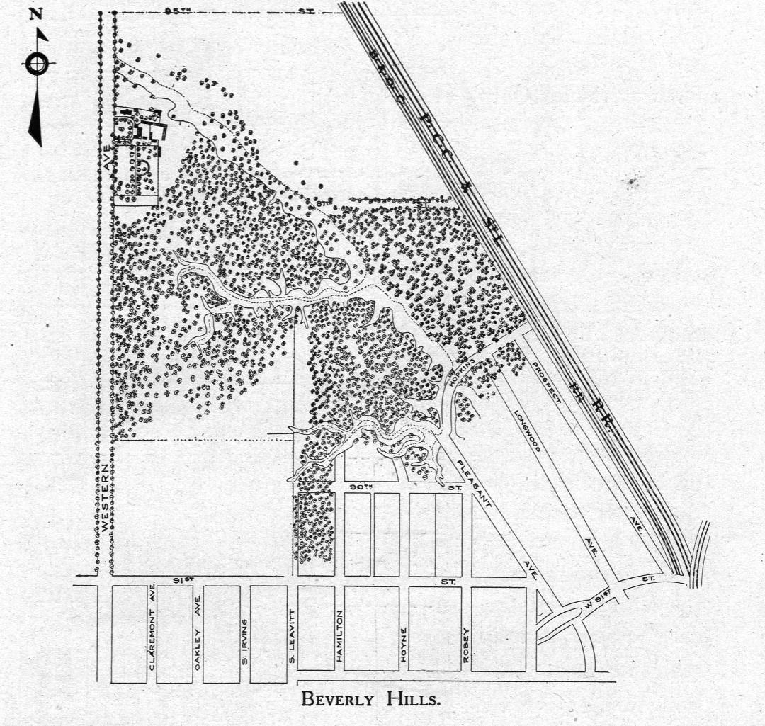
On November 10, 1916, a small article in the Chicago Daily Tribune reported that the Cook County forest preserve board would have a walk through the woods at Beverly Hills that day, with an eye toward purchasing them. That visit surely went well, because in September 1917, for the price of $152,937, the forest preserves district purchased 112.88 acres from the estate of John B. Sherman. The area was roughly bordered by Western Avenue, 83rd Street, the Rock Island railroad tracks and 89th Street.
The following year, the Forest Preserves of Cook County (FPPC) issued a report that enthusiastically praised the Beverly Hills Preserve. Peter Reinberg was President of the Cook County Board of Commissioners at the time, and the board also had responsibility for the forest preserves. Daniel Ryan was on the Board and was Chairman of the Finance Committee and Chairman of the Depositories Committee, and a member of the Real Estate, Plan, and Forestry and Improvement Committees.
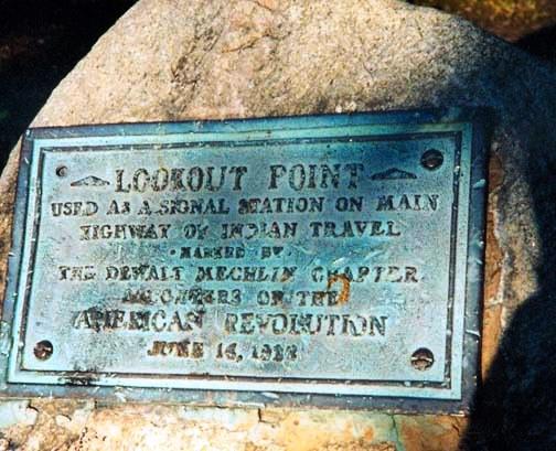
The 1918 report stated that the location had long been recognized as a historical attraction because of the towering bluff “Indian warriors utilized as a look-out and signal station in the days when they were fighting to hold their homes against the invading white men.”
This version of the early history of the land recounted the tale of the signal station atop the “Beverly Bluff” bursting into flame with the bonfires of the Indians, which produced ribbons of smoke that warned tribes for miles around.
Of course, as colorful as this story is, it is largely folklore. Without any doubt the Native Americans knew the northern tip of the landmass the white settlers called the Blue Island. There were Indian villages along the Calumet River at the southern end of the island and settlers found many Indian artifacts around the Ridge. Standing on the bluff, one could see all the way to Fort Dearborn, about 12 miles to the northeast. The fort was located about where the Michigan Avenue bridge is today, where the Chicago River joins with Lake Michigan (333 N. Michigan Ave,).
For some time, white trappers and traders had been following the Vincennes Trail through the prairies and wetlands and oak savannas of the Blue Island Ridge area. This trail was first worn by animals keeping to the high ground, then used by Native Americans. It ran south from Chicago, then east to Vincennes, Indiana.
Settlement of the Blue Island area by white families was gradual. By the time they began to put down roots here in earnest in the 1830s, the Native Americans in this area were almost all gone, due to the federal Indian Removal Act of 1830. The Treaty of Chicago in 1833 led to the final withdrawal of the Potawatomi, Chippewa, and Ottawa tribes from the Lake Michigan area.
Native Americans were still spotted in the area for decades afterwards. Although there was some fear and mistrust of them on the part of some of the white settlers, there were no large scale hostilities reported in the early histories. One early settler wrote about riding his pony as a boy across the prairies with the local Indians.
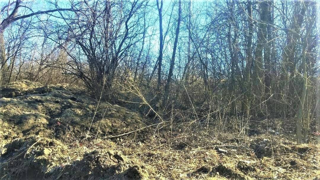
In 1922, the Dewalt Mechlin Chapter of the Daughters of the American Revolution placed a marker in the woods along the north side of 87th Street to commemorate the Indian lore that earned the bluff the name “Lookout Point.” That marker should still be there. [Note: It has since been reported that this plaque went missing 2-3 years ago. Pictures are all that remain.]
The 1918 report was full of praise for the Beverly woods, stating, “In Beverly Hills, the southern end of Cook County has a real beauty spot. It is a preserve only 126 acres in extent but for its acreage it boasts more spectacular points of interest than any other stretch of forest land in the county. It is an ideal natural park.”
The report also pointed out that the Beverly preserve had the distinction of being the only one accessible to all of Chicago “on a five cent fare.” Visitors could take the Ashland Avenue streetcar to 87th Street and walk west to the Ridge. Another option was to take the Rock Island train from the LaSalle Street station to the Beverly Hills station at 91st Street.
The 1918 report included a map of the woods as they were at the time they became part of the forest preserves. The map includes structures that likely dated back to the days when the land was the Sherman Farm, filled with “splendid herds of stock.”
The next installment will look at the formation of the forest preserves, and the “Sherman Farm at Forest Hill.”
The history of Dan Ryan Woods – Part 20: The “Lungs” of the City
By Carol Flynn
The history of the land and events that went on in the Forest Preserves of Cook County (FPPC) and Dan Ryan Woods (DRW) have been the focus of most of this series so far. This post will discuss the woods themselves.
Frederick Law Olmsted, the public health proponent and landscape architect, used the term “the lungs of the city” in 1872 to emphasize the importance of public parks as open green spaces where city dwellers could breathe clean air. He was speaking in terms of the prevailing belief of that time that diseases were caused by breathing “bad vapors” and could be avoided and cured by good ventilation and plenty of fresh air. While we know much more now about bacteria and viruses that are the actual causes of diseases, we also know that Olmsted was more correct about the importance of green spaces than he could have imagined, but for other scientific reasons.
A green space like DRW not only benefits the community recreationally and aesthetically, but also ecologically. According to the U.S. Forest Service’s Urban Forest Ecosystem Research Unit and many other sources, it is well documented that trees absorb pollutants such as carbon monoxide and sulfur dioxide and break them down into less harmful substances. Trees also remove carbon dioxide, a potent greenhouse gas that traps heat and contributes to global warming, and through the process of photosynthesis, release oxygen into the air.
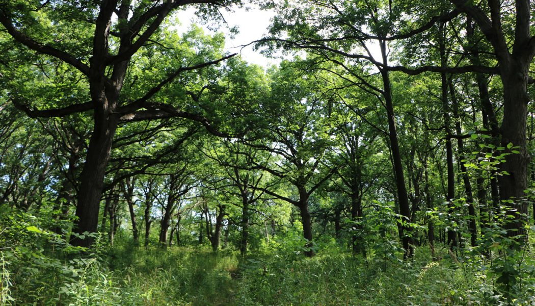
The FPCC describes the top of the Ridge in DRW as an open woodland made up primarily of oak and hickory trees. The trees are spaced far enough apart to allow sunlight to reach the forest floor, where plants such as red trillium, thicket parsley and wild geranium thrive. Open woodlands were one of the predominant ecosystems once found throughout the Chicago area before development.
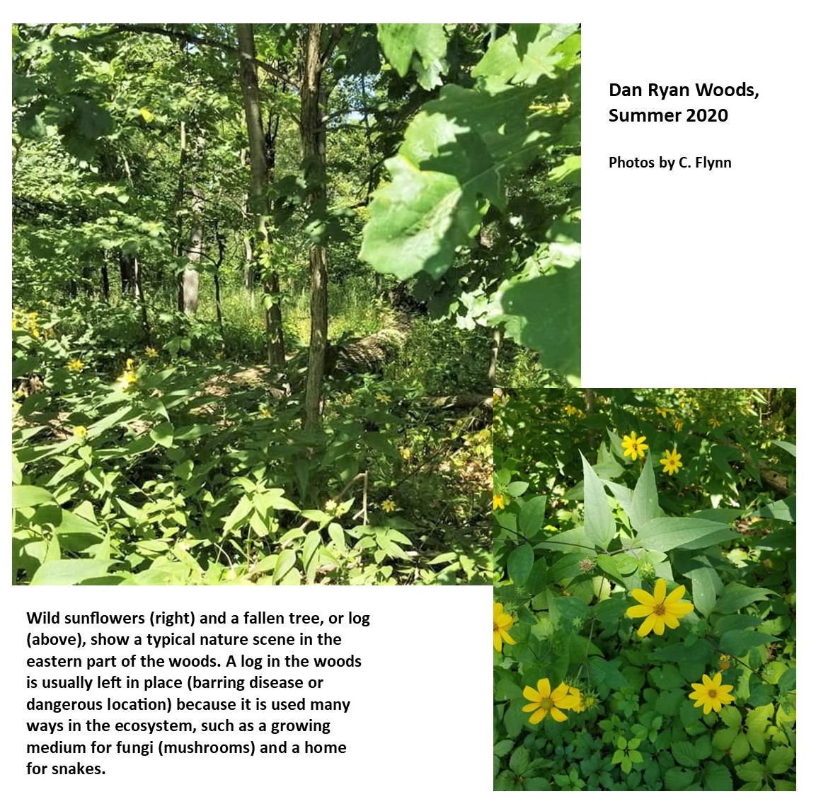
The east side of the woods, below the Ridge, is described by FPCC as “wet woods” dominated by swamp white oaks, red oaks, and American basswood. Pale-leaved sunflower, fringed loosestrife and many sedges and manna grasses cover the ground below. These are all plants that can withstand flooding, as they receive the run-off of water from the Ridge.
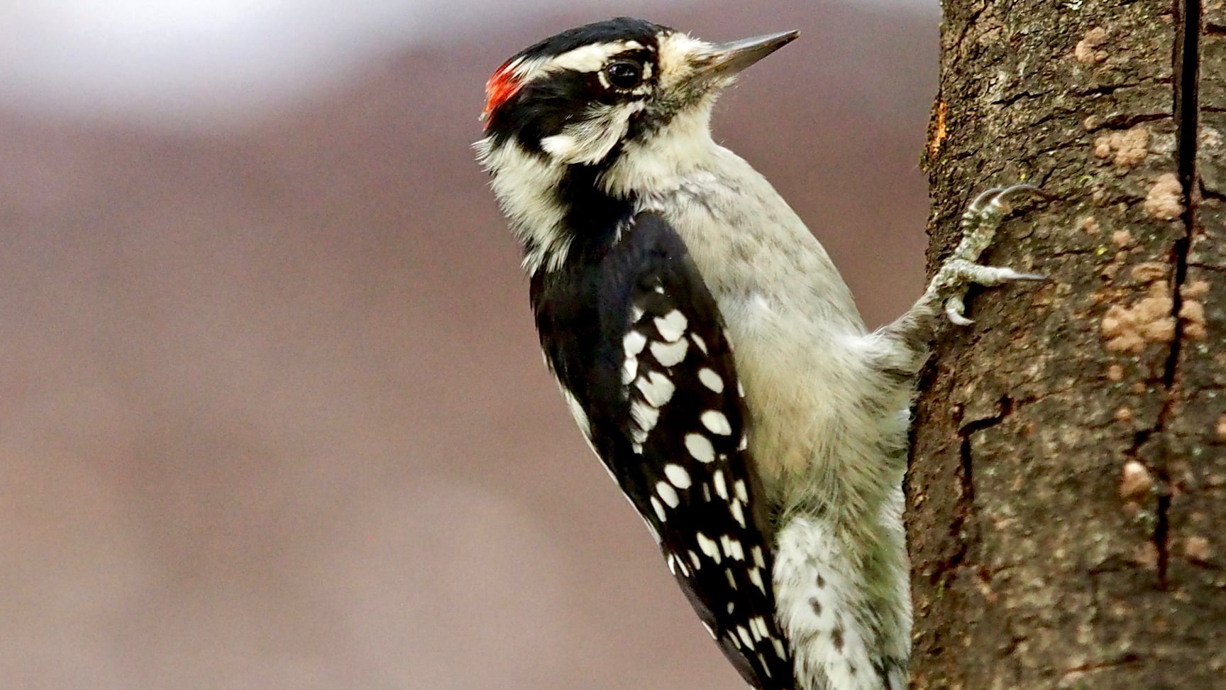
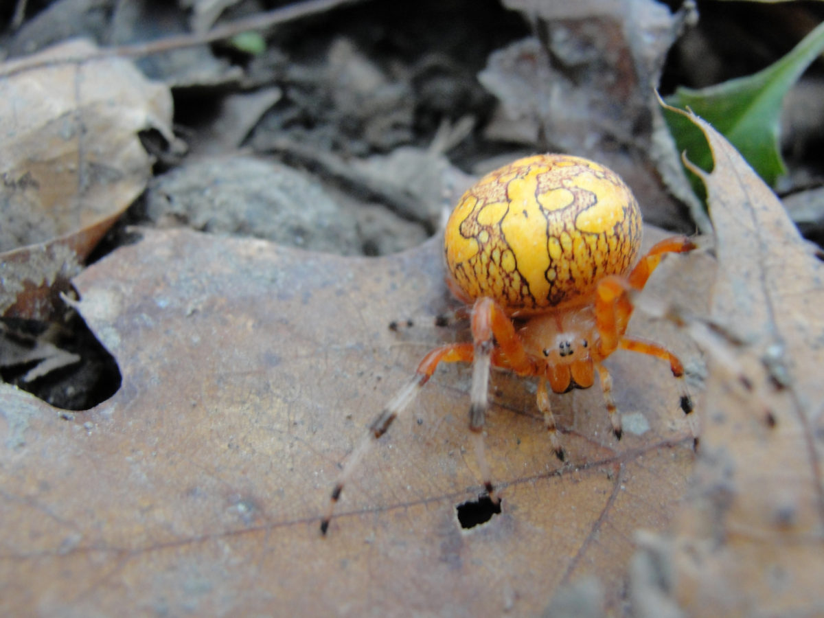
Bird watching is a favorite pastime in DRW and all the preserves. Birds that may be seen in DRW include hawks, owls, woodpeckers, warblers, goldfinches, hummingbirds, and many more. In addition to the wildlife that can be spotted, like birds and rabbits, the forest is teeming with life visitors do not always realize is there: bees, butterflies, spiders, snails, crickets, grasshoppers, earthworms, and many other tiny creatures, and microorganisms too small to be seen by the human eye. Every one of these creatures has an important role in the ecosystem.
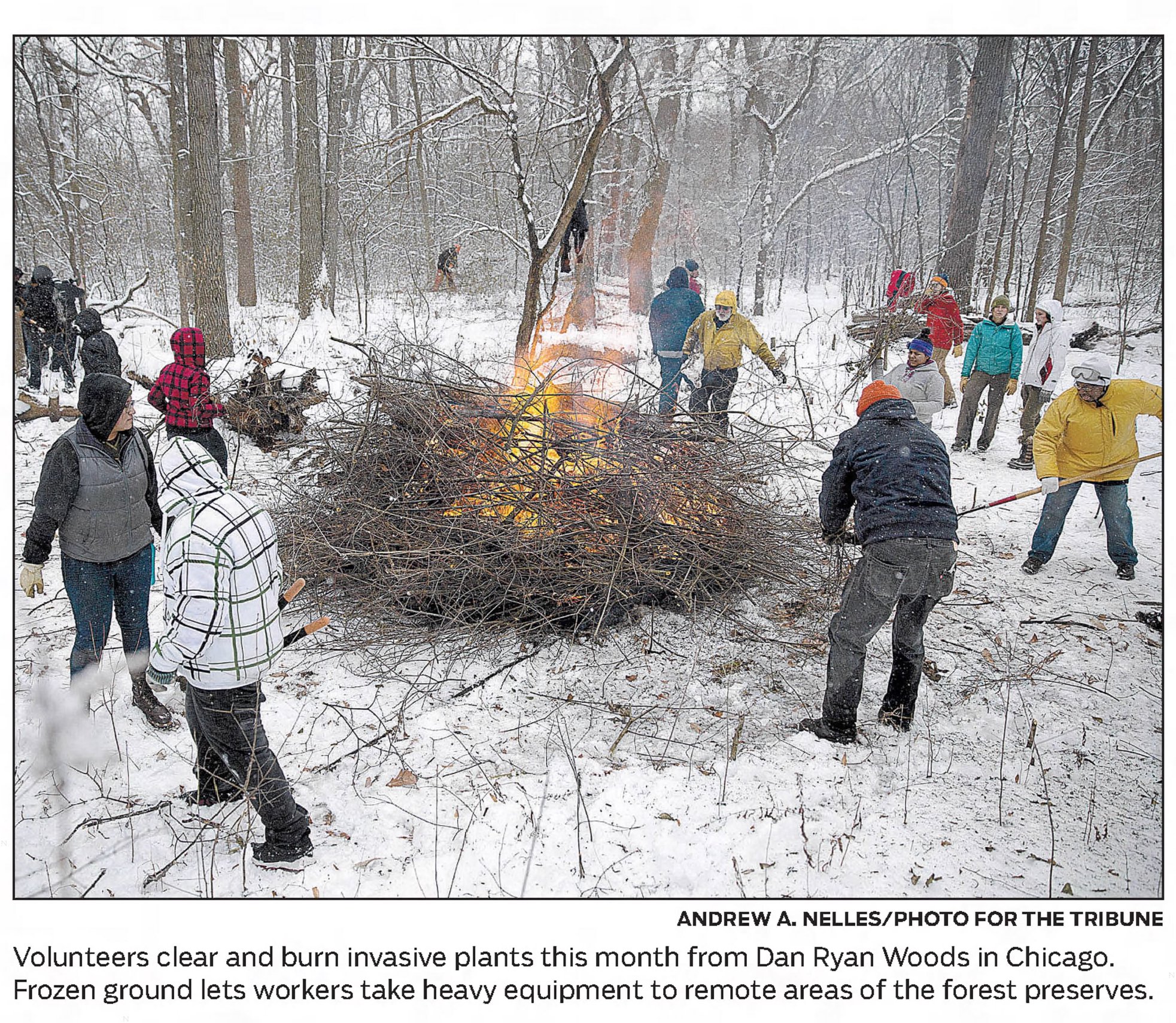
Gone from DRW are the elm trees that once were plentiful around Chicago. The FPCC lost over 100,000 trees due to Dutch Elm Disease, the fungal infection spread by elm bark beetles, after the disease entered the U.S. in the 1950s. In more recent years, DRW has lost hundreds of trees to the emerald ash borer. Dozens of invasive plant species such as buckthorn are also enemies of native ecosystems. Removing invasive plants from DRW and the other preserves is an on-going challenge.
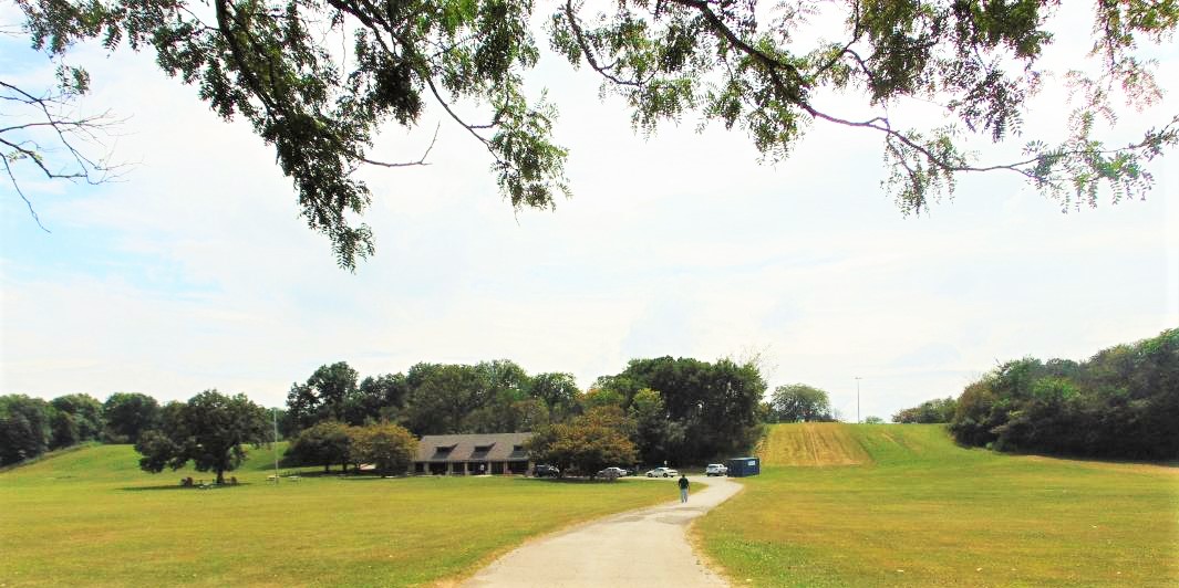
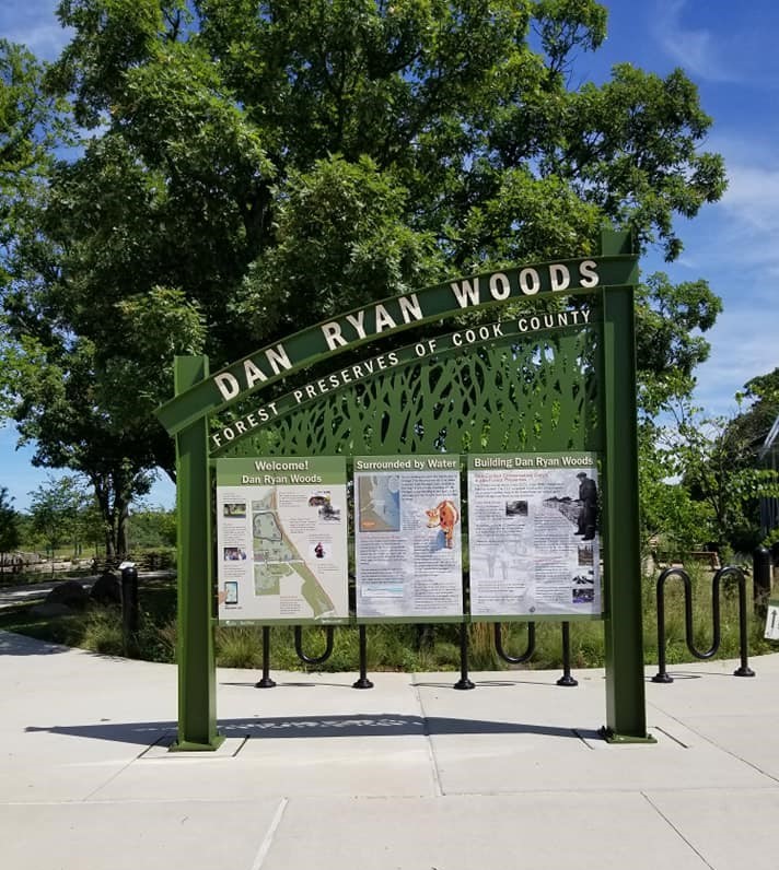
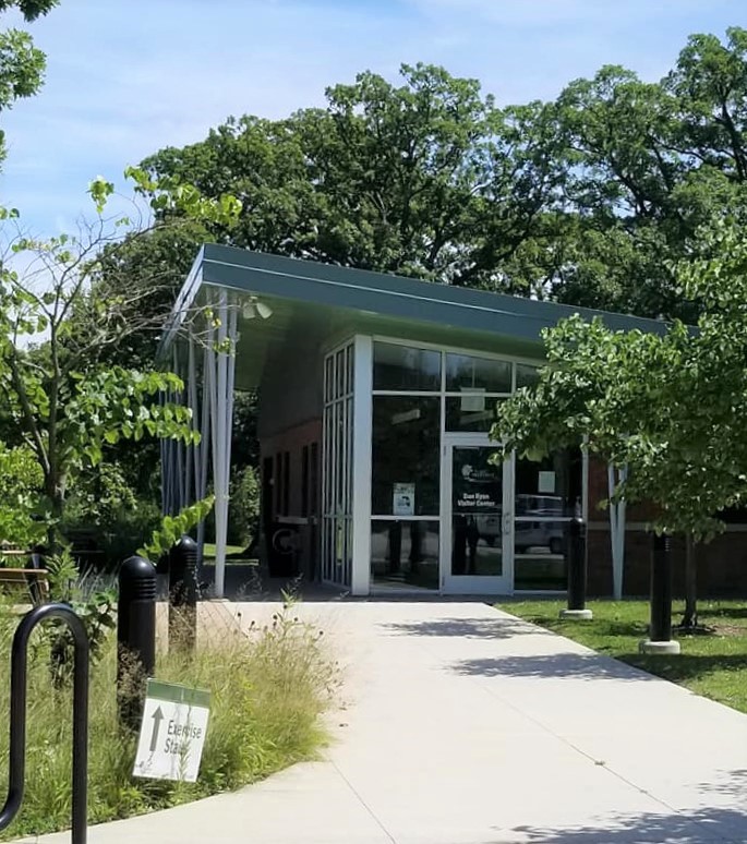
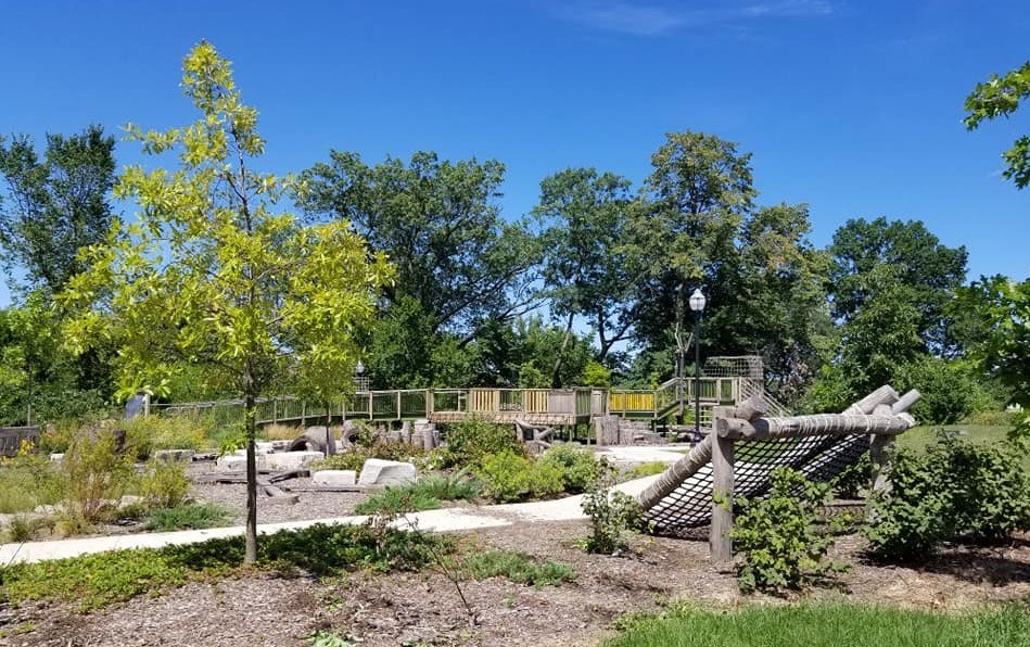
FPCC continues its mission of conservation, education, and recreation. At DRW, some new features were introduced in recent years, including a new visitors’ center and a nature play space with a treehouse walkway. The pavilion, or warming shelter, is available for events, and of course, picnic groves and trails have been available for 100 years.
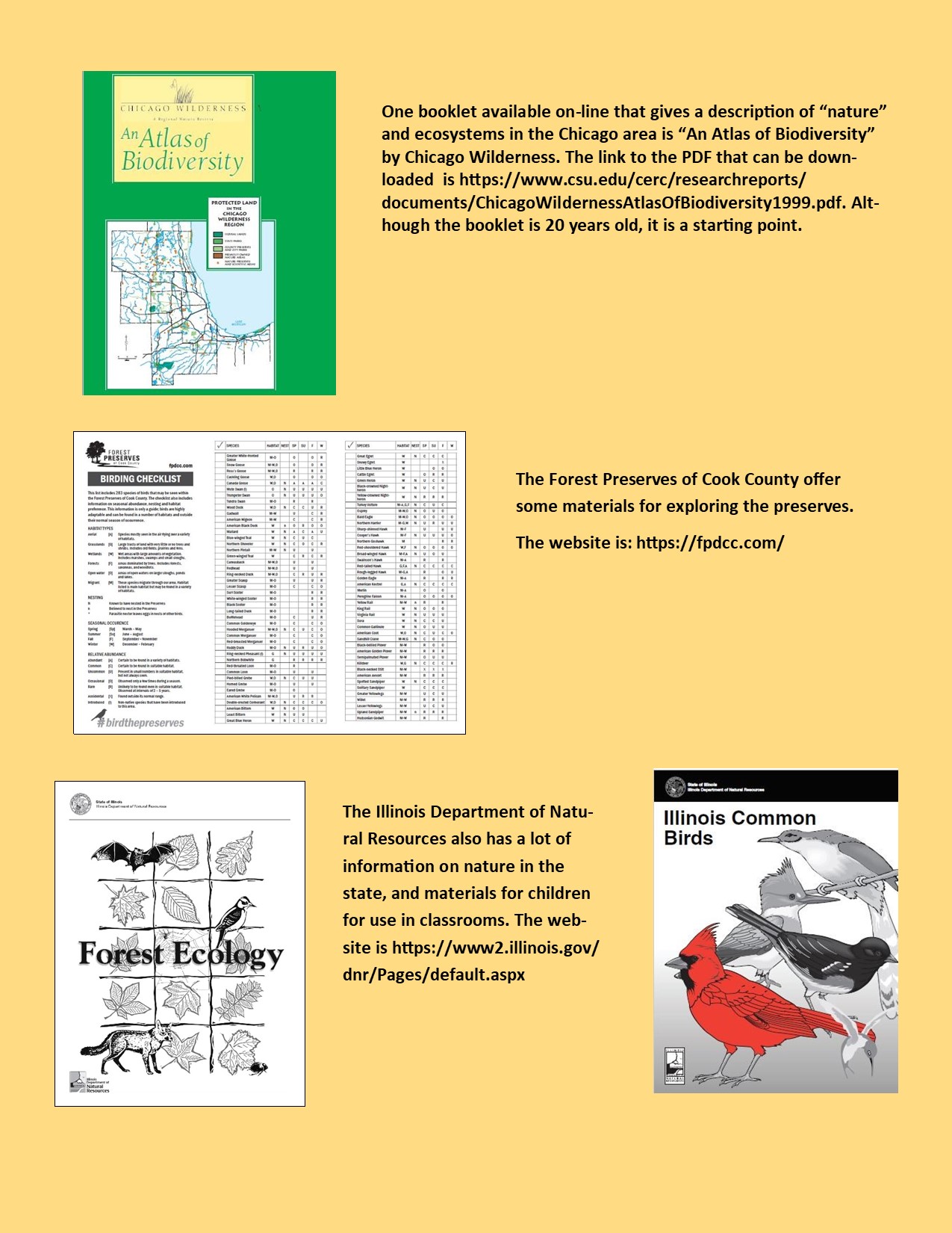
The website for the FPCC, https://fpdcc.com/, shares information on accessing the preserve and can be checked for updates to programs and services affected by the pandemic.
Different volunteer groups work with FPCC on projects. One group is the Friends of the Forest Preserves (FOTFP), founded in 1998 as a grassroots non-profit organization that works to protect, restore, and promote the preserves. FOTFP offers a variety of ways to get involved in the preserves, including restoration projects and photo contests. The website is https://www.fotfp.org/.
Last year FPCC adopted a Land Acknowledgement Statement, which recognizes and shows respect for the past and on-going relationship that Native American tribes share with the land. This is particularly appropriate as the forest preserves are really the only places left where archeological remains of the vast Native American presence in the Chicago area dating back for 13,000 years can still be found undisturbed.
The FPCC Land Acknowledgement Statement dated 2019 is:
“The Forest Preserves of Cook County acknowledges that we are on the ancestral homelands of the Council of Three Fires—the Ojibwa, Ottawa and Potawatomi tribes—and a place of trade with many other tribes, including the Ho-Chunk, Miami, Menominee, Sauk and Meskwaki.
“As a land management agency, we acknowledge that we have played a role in shaping the histories of local Native Americans by acquiring this land. We must also recognize, share and celebrate the history of local Native Americans and their immemorial ties to this land.
“We commit ourselves to developing deeper partnerships that advocate for the progress, dignity and humanity of the many diverse Native Americans who still live and practice their heritage and traditions on this land today.”
This brings us full circle back to the beginning, when the tip of the Ridge was known as “Look Out Point.” The folklore about Indians and the land now known as Dan Ryan Woods might be more fanciful than historic, but acknowledging that the Native Americans were here long before the settlers came is a good way to reinforce Cook County’s stewardship role for the land and its ecosystems, and the duty of county residents and the other users of the preserves to protect them.
Dan Ryan Woods offers a small but significant remnant of the “wild Ridge” that existed before development. Other posts on the RHS Facebook page have discussed the natural history of the area, the oak savannas, the prairies, the wetlands and marshes with their abundant wildlife and native fruit and nut trees that covered the area, through the observations and experiences of the early settlers.
The next and final post on the history of Dan Ryan Woods will discuss a favorite topic related to the earliest days of the ”wild Ridge” – Horse Thief Hollow.
The Paranormal Ridge: Part 4 – Why the Ridge has Paranormal Activity
By Carol Flynn
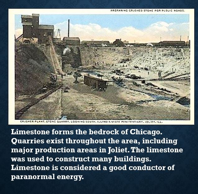
The Blue Island Ridge seems to have a fair amount of paranormal activity going on; so far, over seventy ghost stories have been reported here. It appears that at least four factors come together to support and even encourage this paranormal activity. The four factors are limestone, water, railroad tracks and Native American heritage.
First, the bedrock that Chicago sits on is 400-million-year-old limestone. This limestone base formed from deposits left on coral reefs in the shallow inland seas that covered most of the area. Limestone is considered to have the strong capability to absorb and release electromagnetic and psychic energies.
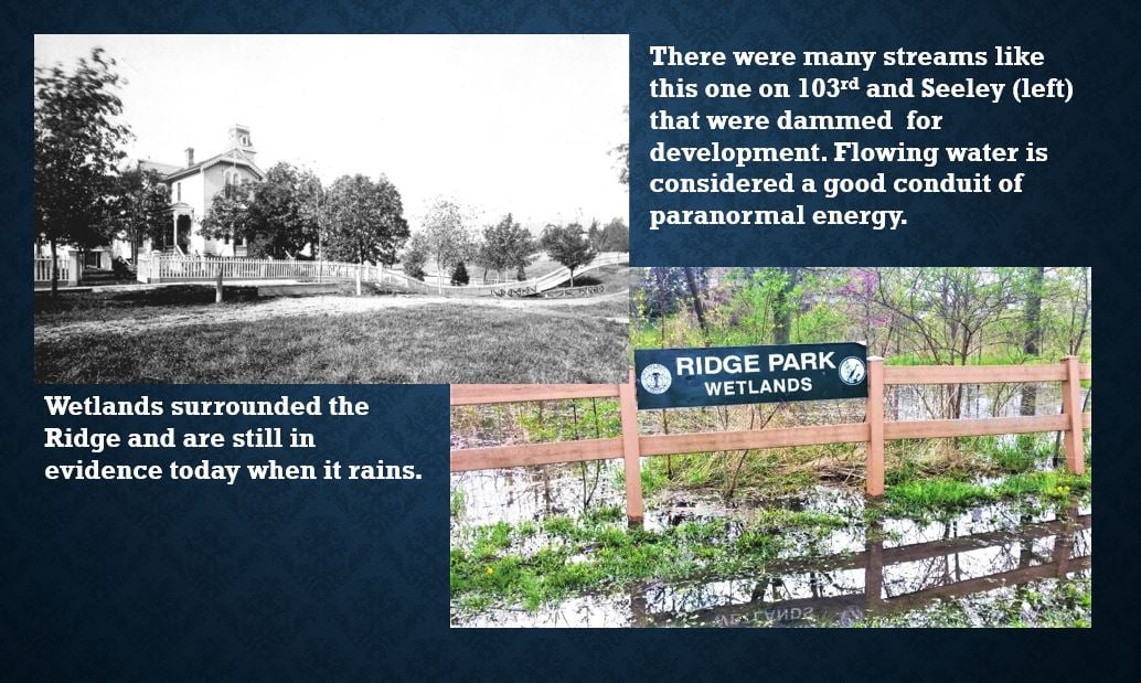
The second factor encouraging paranormal activity is flowing water. Water is considered a great conductor of paranormal energy and there is water all around and under the Ridge. The Ridge has underground streams and wells that were dammed up and built over. The land to the east of the Ridge was originally seasonal wetlands. When it rains, the water drains to the east, flooding lawns and streets and sometimes basements.
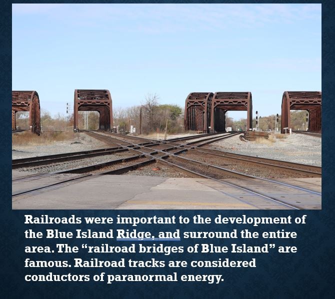
Thanks to an article with an interview with Jason and Grant of the original Ghost Hunters TV series, the third factor was identified. Jason and Grant were the Roto-Rooter employees in New Jersey who had the first and the best show on the Sci-Fi channel for exploring the paranormal. They investigated hundreds of sites, and they found over and over three things came together – limestone, water, and railroad tracks.
Railroad tracks are all around the Ridge. The railroads have been of major importance to development here. The stations along the Metra line are a Chicago landmark district, and Blue Island was a major railroad hub – it still has that enormous railroad yard. Again, it seems railroad tracks hold and conduct energy.
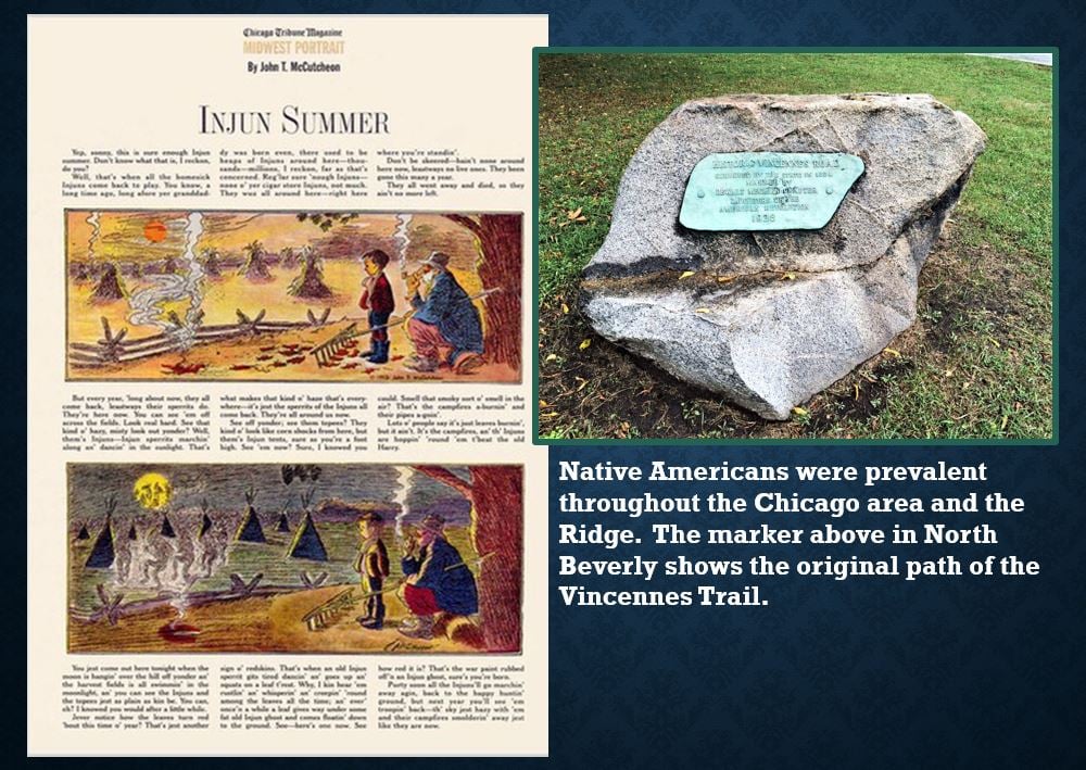
The last factor is the strong historical presence of Native Americans. These were lands for the Pottawatomie tribe, and before that the Illinois tribe. An old Indian trail, the Vincennes Trail, runs through the Ridge. A marker for the original route that ran across the top of the Ridge can be found in North Beverly.
One psychic shared, completely unsolicited, that she can really feel the Native American presence here and at times the veil is so thin that she can sense the phantoms of Indians along the Cal-Sag Channel at night. That waterway was originally the Stony Creek back in the day of the Indians. They lived along the Calumet River and the creek until being removed as a group from the Chicago area in the 1830s. Spirits figure prominently in Native American folklore and beliefs.
A little on the history of ghost stories and Halloween, the signs of possible hauntings, and the factors influencing paranormal events on the Ridge have been covered as background material. The next post will get into the ghost stories surrounding the Givins Beverly Castle.
Native Americans in the South Side Communities
Seeking: People from the Blue Island Ridge communities and other south/southwest Chicagoland areas who are of Native American descent who would be willing to talk to me about their perspectives and experiences living in this area.
Why?
What we are working on: We are currently finishing up a background paper on the history of Native Americans in the Blue Island Ridge communities that can serve as a beginning point for local groups or individuals writing Land Acknowledgement Statements, or putting together any kind of programs on the topic, etc. This will be available to anyone who wants it. We will run this as a series on Facebook, also. This will be a constant "work in progress" updated and enhanced regularly. It is not an exhaustive document, it is a beginning point to help people get familiar with the history and issues.
I have plenty of historical resources – we've been in touch with the American Indian Center, Newberry Library, we have resources from the University of Chicago, plenty of books and articles and old maps and local history resources. I am looking for real, everyday people to talk to.
I intend to turn this into a general article for the Daily Southtown newspaper, expanding the information to include points west and south of the Ridge – Palos, Will County, Thornton, etc.
It is reported that there are around 65,000 Native Americans representing 175 Nations in the Chicago area, but most of these people are concentrated on the North Side. There is very little Native American presence reported in the Blue Island Ridge communities. Depending on the source, the population of Native Americans or “Other” which includes Native Americans is always given as less than 2%. One source lists 0% for Mount Greenwood and Washington Heights, 0.4% for Beverly, 0.9% for Morgan Park, and 0.8% for Blue Island.
My guess is that there are people with some Native American ancestry who are counted in the other groups.
So I would love to "meet" some people of Native American ancestry who would agree to be interviewed. They can contact me personally through Messenger, or through the RHS Facebook page – I see the messages but they are not made public. Please feel free to share this request with anyone you know.
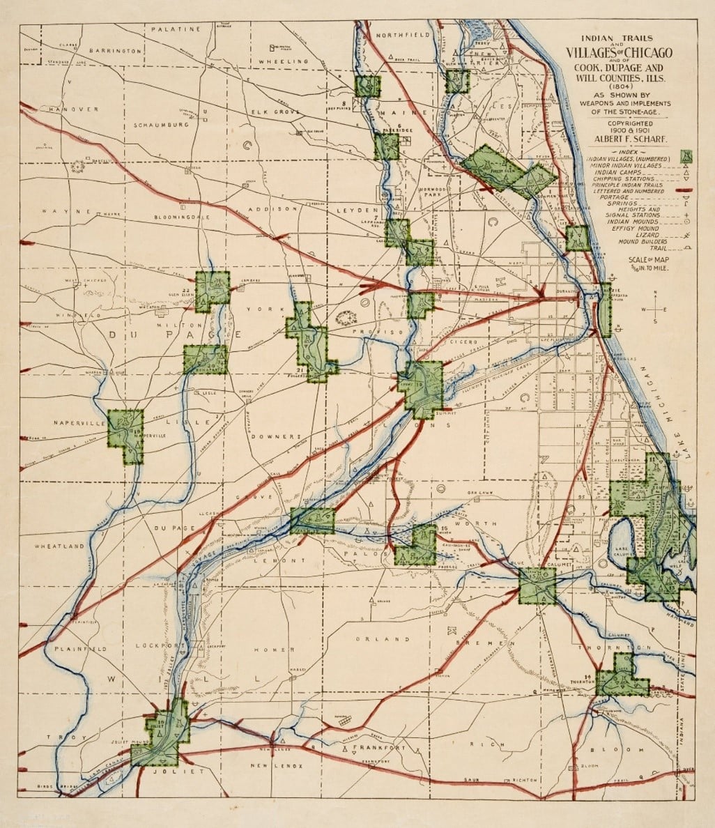
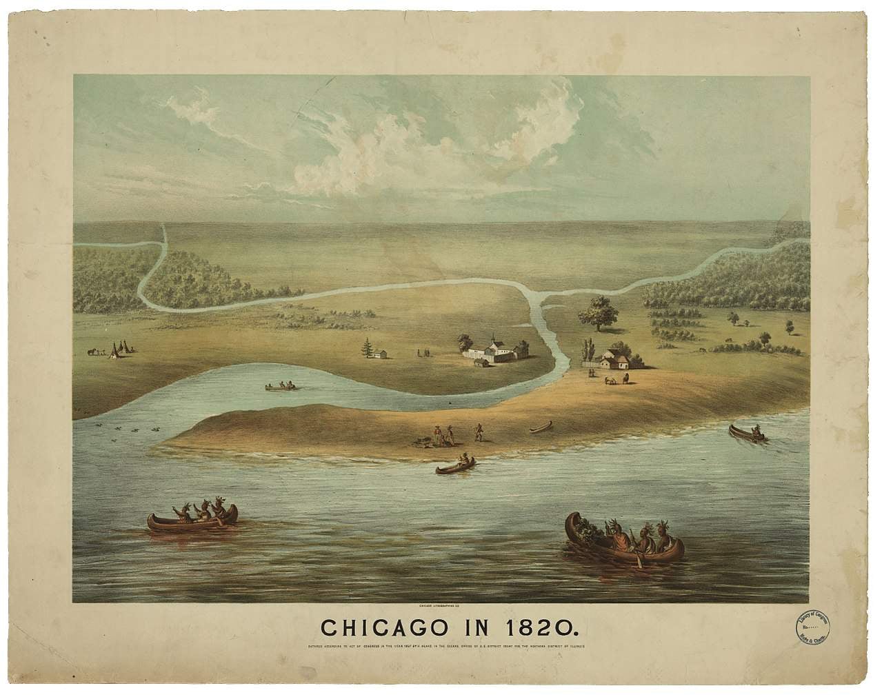
Here is a very interesting map, going back to 1804, updated and reproduced in 1900-01, showing Indian trails and sites in the area. Note the outline of the Blue Island and the sites in the area.
Earth Day 2021
Edited: I did not mention Dan Ryan Woods in my original post! Of course, the forest preserve connects us to Earth Day and the "Wild Ridge." That is an obvious example. The upper woods are an example of "Open Woodlands," an ecosystem that was prevalent in the area. Water drained from the top of the Ridge to the east into the lower woodlands where the water pooled into wet areas before being absorbed into the ground. Descriptions of the "island" itself reported that the sides were heavily wooded and much of the top of the table of land was prairie.
Following is information about the other ecosystems of which there are still remnants in the Ridge area.
Thursday, April 22, is Earth Day. It is a global event established in 1970 to support environmental protection. The theme this year is Restore Our Earth.
This is a good opportunity to once again share a favorite history topic – the “Wild Ridge.” This is a look back at the natural environment of the Ridge before it was “developed” by European settlers. There are a few remnants of the land left from the days when it was the ancestral homelands of Native Americans.
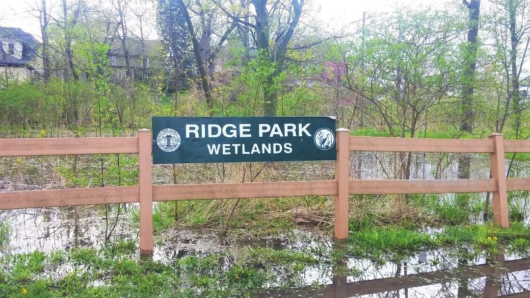
The Ridge Wetlands is a teeny-tiny remnant of the marshes and sloughs that predominated in the land between the Ridge area and Lake Michigan. This land provided abundant nourishment and other life necessities for wildlife and Indigenous Peoples – wild rice, berry brambles, and other food plants; stop-overs and breeding grounds for migratory waterfowl; ecosystem for fur-bearing animals like beaver and muskrats.
Note that this is why so many lawns and basements to the east of the Ridge flood – they are built on natural wetlands and there is no place for the water to go. The water is supposed to be there – houses are not!
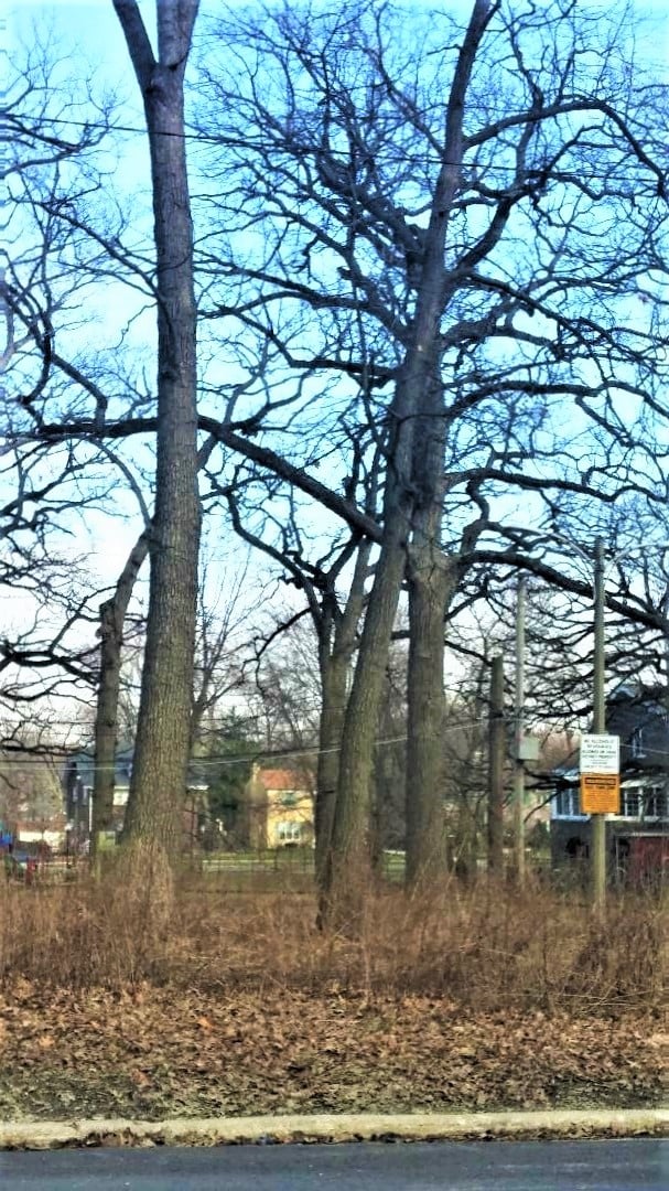
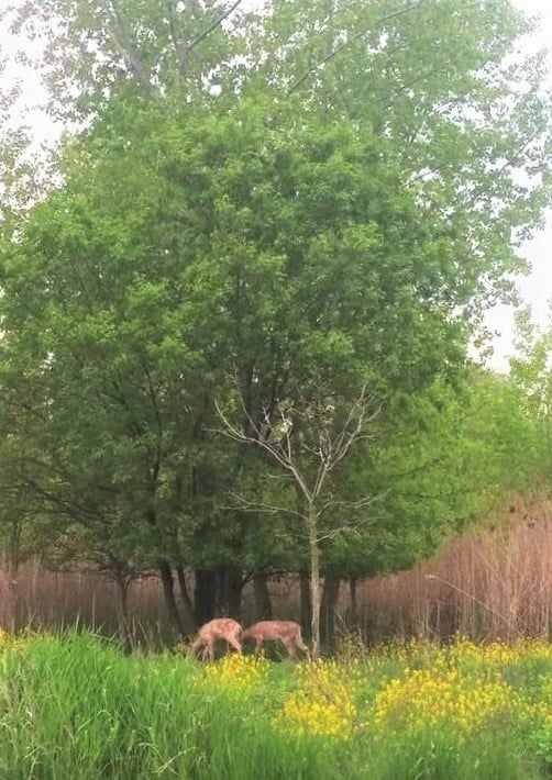
The Oak Savannah remnant at Hurley Park. The drier areas had numerous groves of timber, predominated by oak. Also included were fruit trees like apples and plums, nut trees like walnuts and hickories, and birch trees good for making canoes. Numerous species of birds and small mammals made their homes in the trees. Deer and bears and lynx found refuge there.
Note that many of the heritage oak trees in the Ridge areas are reaching the end of their lifespans, about 200 years. They have not been replaced. Within the next 50 years, a lot of these trees will die, and the tree canopy will be gone.
Vast stretches of prairie land were the migration path for buffalo, as well as the home for countless species of birds and small mammals, and wild food plants, including the wild onion or garlic that gave Chicago its name.
Any substantial prairie land is gone from this area. Some prairie remnants can be seen in local cemeteries.
The waterways, the Calumet River system and Stony Creek at the southern edge of the Ridge, teemed with fish – trout, pike, bass, perch, etc.
Stony Creek was absorbed into the Cal-Sag Channel. The Illinois Department of Public Health puts severe restrictions on eating fish caught from the Calumet system due to contamination.
The sand dunes which formed on the western side of the Blue Island, which can still be seen today in the cemeteries along that ancient shoreline, also had their own ecosystem of plants, birds, and other animals. Wolves built their dens there, in the well-drained soil.
RHS is using Memorial Day to announce our next feature series, which will be on the Native American heritage of the Ridge.
Right now, organizations, universities, churches, businesses, etc., are developing “Land Acknowledgement Statements.” These are declarations that recognize that the land we are using today was the ancestral homelands of Indigenous Peoples who lived here for at least 13,000 years before the European settlers came.
To help with land acknowledgment statements for the Blue Island Ridge, a background paper on the Native American presence on the Ridge has been evolving through research efforts at RHS. This is a fascinating and complex topic. Information will be shared through the Facebook page and other RHS communications and programs as time goes on.
Why start with Memorial Day? For two reasons. First, Native Americans have a long and unrecognized history of service in the U.S. Armed Forces. For many people, the only glimpse they have had into this part of history was through the 2002 movie “Windtalkers” which was based on the real story of Navajo code talkers during World War II. The Navajo language was used to direct artillery operations in the field, and the “code” was never broken by the enemy.
Native Americans serve in the U.S. Armed Forces at a higher rate than any other group. Since the 9/11 terrorist bombing, 19% of Native American men and women have served, compared to an average of 14% for all other groups. This is consistent among the 573 federally recognized Native American tribes.
In interviews, they cite their reasons for enlisting. Of course, the economic factor cannot be ignored – pay, benefits, opportunities. But for many, there is a family heritage, and the time-honored warrior culture of protecting their land, their home, their family, their ideals. Native Americans are not just part of the United States’ past, they are very much the present and future, also.
Second, in exploring the history of the Memorial Day Parade, which has gone on in this community for over 100 years even though canceled for 2020-21 because of the COVID pandemic, we came across an intriguing picture, from the scrapbook of the RHS President Elaine Spencer.
Elaine was a student at Morgan Park High School in the late 1940s. She participated in the Memorial Day Parade and a family member took photos. In her scrapbook is a picture from 1948-50 which is labeled “Real Indians” in the parade (shown here).
From all appearances, these do look like Native Americans in ceremonial dress and we continue to investigate their background, through the American Indian Center of Chicago, which opened in 1953, and other means.
At the time, there were only about a thousand Native Americans reported living in Chicago. Right after this, in the 1950s-1960s, there was a government relocation program to move Native Americans to urban areas, and thousands more came here, but that had not happened yet.
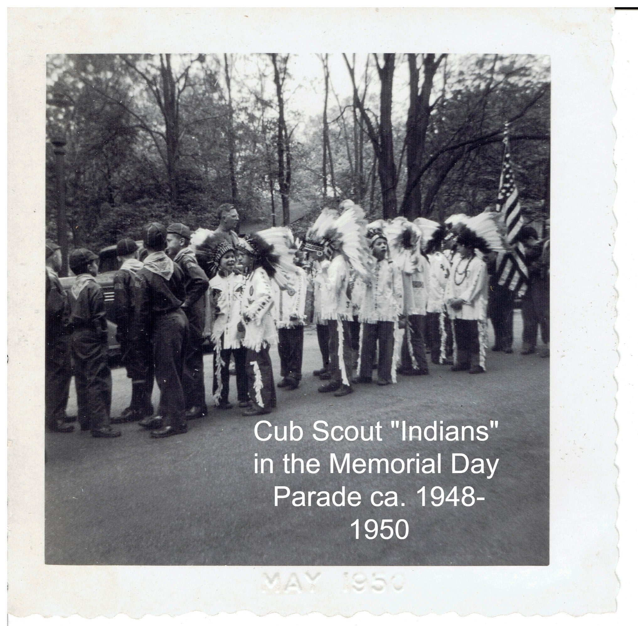
It was not unusual for Scouts and other groups, including adults, to take “Indian” names and dress in costumes, and there were marchers reflecting that also. Their look is very different from the “Real Indians.” A picture of a Cub Scout group dressed in their version of "Indian" attire is also shown here.
Stay tuned for the series on Native Americans and the Blue Island Ridge.
Native Americans and the Blue Island Ridge – Part 1Introduction
This series on Native Americans and the Ridge evolved from research for a background paper being prepared to assist local organizations in developing “land acknowledgment statements.”
It became evident that what started as a “history paper” could not be quickly or easily addressed. The history of Native Americans is very complex and, like all history, not static – viewpoints and “facts” are always changing as new information is found and old information is reinterpreted.
More importantly, Native Americans are not just part of the past – they are very much part of the present and future of this country.
This series will begin the exploration of some topics related to Native Americans in this area and readers are encouraged to seek out additional information and resources.
In recent years, governments, universities, cultural organizations, churches, and other institutions have begun recognizing the Native American heritage of the land through land acknowledgment statements (LAS). These are formal declarations put out in writing that note the organization is located on land that was once the ancestral grounds of Native Americans.
These statements first started being used in Canada in 2015. They are often read aloud at the beginning of an event. In Canada, they are regularly included at events ranging from parliament sessions to ballet performances to National Hockey League games.
Last year, Chicago-area groups began issuing land acknowledgment statements.
The Field Museum of Natural History, not surprisingly, has a website page devoted to the topic. We will make references to that in our posts.
The Forest Preserves of Cook County also has issued a LAS, which includes the northern tip of the Ridge, located in the Dan Ryan Forest Preserve.
A typical LAS begins, “We acknowledge that the [name of organization] resides within the traditional homelands of [name of Indigenous Peoples].” This is usually followed by additional comments supportive of Native Americans.
Land acknowledgment statements have their issues, of course. One logical question after hearing or reading such a statement is what is the relevance to today? How do we make this statement something useful and meaningful to today’s Native Americans?
In April, RHS was contacted by a representative of the Beverly Unitarian Church who was working on a LAS for that organization. Discussions and research led to a Zoom meeting with John Low, Ph.D., J.D., a professor at Ohio State University, who is an enrolled citizen of the Pokagon Band of Potawatomi Indians.
In discussing how to make a LAS meaningful, Dr. Low commented that each organization has to look at its situation and determine how best to do that. We agreed that for a small, local organization like RHS, the obvious role is one of education through written materials, programming, etc., to help the community understand the heritage of Native Americans in this area. We will attempt to do that.
Next post: Part 2: Native Americans and the United States