
Explore the RHS Facebook Archives, a rich repository of local history written by Carol Flynn. For two decades, Carol brought a deeply dedicated voice to public education at RHS. Her role as Facebook administrator through mid-2025 naturally extended her prolific research into meticulously detailed articles, most notably her multi-part historical series posts. Today, Carol continues her local history writing for The Beverly Review and other outlets.
All Posts


From the Ridge Historical Society: The Chicago Tribune has an article today about a charming historic building in Lincoln Park now destined for demolition. Every time this happens, we lose a little piece of history.
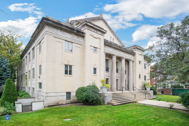
Many historic buildings in Beverly/Morgan Park fell to the wrecking ball over the years, but there is one example of "adaptive reuse" we can point to with pride – the saving of the Christian Science church and reading room on 103rd and Longwood Drive.
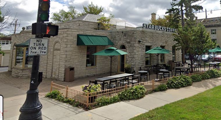
The Thirteenth Church of Christ, Scientist, was founded in Beverly in 1914. The congregation built an impressive neoclassical building in 1916. In 1940, the Reading Room was built on the corner just north of the church. Christian Science Reading Rooms are bookstores and quiet places for study and prayer.
The congregation dwindled with time, and by the late 1980s, the church was barely being used. A creative solution for repurposing the church was suggested: converting the interior into condo units. In 1992, the Bell Tower Loft Condominiums went on the market. The external façade of the building was preserved.
The congregation continued the Reading Room for over another decade, remodeling it to also use as a church. In 2006, the building was sold, and now there is a Starbucks coffee shop on site. The interior was remodeled but the exterior retains the original look.
This is the Tribune article about the building closing in Lincoln Park: https://www.chicagotribune.com/columns/mary-schmich/ct-met-schmich-dairy-teardown-20200513-ay6x45og3bejlgme3zjeertmbu-story.html?fbclid=IwAR2MS9KYKEfjy0K6WtReXFgapl8iQy6bG0AGZzpA2ksMhhQMHqtBnd2QM_4
The attached pictures are of the church-turned-condos and the reading room-turned-coffee shop at 103rd and Longwood Drive.
From the Ridge Historical Society: The Chicago Tribune has an article today about a charming historic building in Lincoln Park now destined for demolition. Every time this happens, we lose a little piece of history.
Many historic buildings in Beverly/Morgan Park fell to the wrecking ball over the years, but there is one example of "adaptive reuse" we can point to with pride – the saving of the Christian Science church and reading room on 103rd and Longwood Drive.
The Thirteenth Church of Christ, Scientist, was founded in Beverly in 1914. The congregation built an impressive neoclassical building in 1916. In 1940, the Reading Room was built on the corner just north of the church. Christian Science Reading Rooms are bookstores and quiet places for study and prayer.
The congregation dwindled with time, and by the late 1980s, the church was barely being used. A creative solution for repurposing the church was suggested: converting the interior into condo units. In 1992, the Bell Tower Loft Condominiums went on the market. The external façade of the building was preserved.
The congregation continued the Reading Room for over another decade, remodeling it to also use as a church. In 2006, the building was sold, and now there is a Starbucks coffee shop on site. The interior was remodeled but the exterior retains the original look.
This is the Tribune article about the building closing in Lincoln Park: https://www.chicagotribune.com/columns/mary-schmich/ct-met-schmich-dairy-teardown-20200513-ay6x45og3bejlgme3zjeertmbu-story.html?fbclid=IwAR2MS9KYKEfjy0K6WtReXFgapl8iQy6bG0AGZzpA2ksMhhQMHqtBnd2QM_4
The attached pictures are of the church-turned-condos and the reading room-turned-coffee shop at 103rd and Longwood Drive.


From the Ridge Historical Society
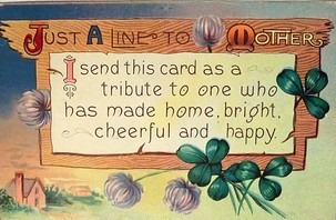
“All that I am, or ever hope to be, I owe to my angel mother.” —Abraham Lincoln
For thousands of years, societies have honored motherhood. The ancient Greeks and Romans paid homage to the mother goddess Cybele. In Rome, she was known as Magna Mater, the Great Mother.
In the United States, modern Mother’s Day actually has its origins in the pacifist movement and concern for Veterans.
Mother’s Day was founded to honor peace activist Ann Jarvis, by her daughter Anna. Jarvis cared for wounded soldiers on both sides during the Civil War. She created Mother’s Day Work Clubs to address public health needs. Her daughter wanted to continue the work her mother started and to honor mothers for all they do.
In 1908, the U.S. Congress rejected the proposal to officially establish Mother’s Day. The men joked they would have to create a “Mother-in-Law’s Day” also. But by 1911, all of the states had adopted the day, and in 1914, President Wilson proclaimed it a national holiday.
Anna Jarvis came to regret she ever came up with the idea when the holiday became excessively commercialized. Hallmark Cards began selling pre-made cards in the early 1920s, and this exploitation of the day for profit infuriated Jarvis. She wanted people to really think about their mothers, to honor their mothers with hand-written testimonials, not to resort to just buying gifts and pre-made cards. She wound up organizing boycotts of Mother’s Day, and was even arrested for disturbing the peace.
Now, the moral of this story is not to stop buying gifts for Mom! It is to sincerely and personally reflect upon her importance in your life, and to acknowledge this to her.
Today Mother's Day is one of the most recognized and celebrated days of the year. It not only honors the mothers of our families; it honors maternal bonds and the influence of mothers in society.
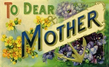
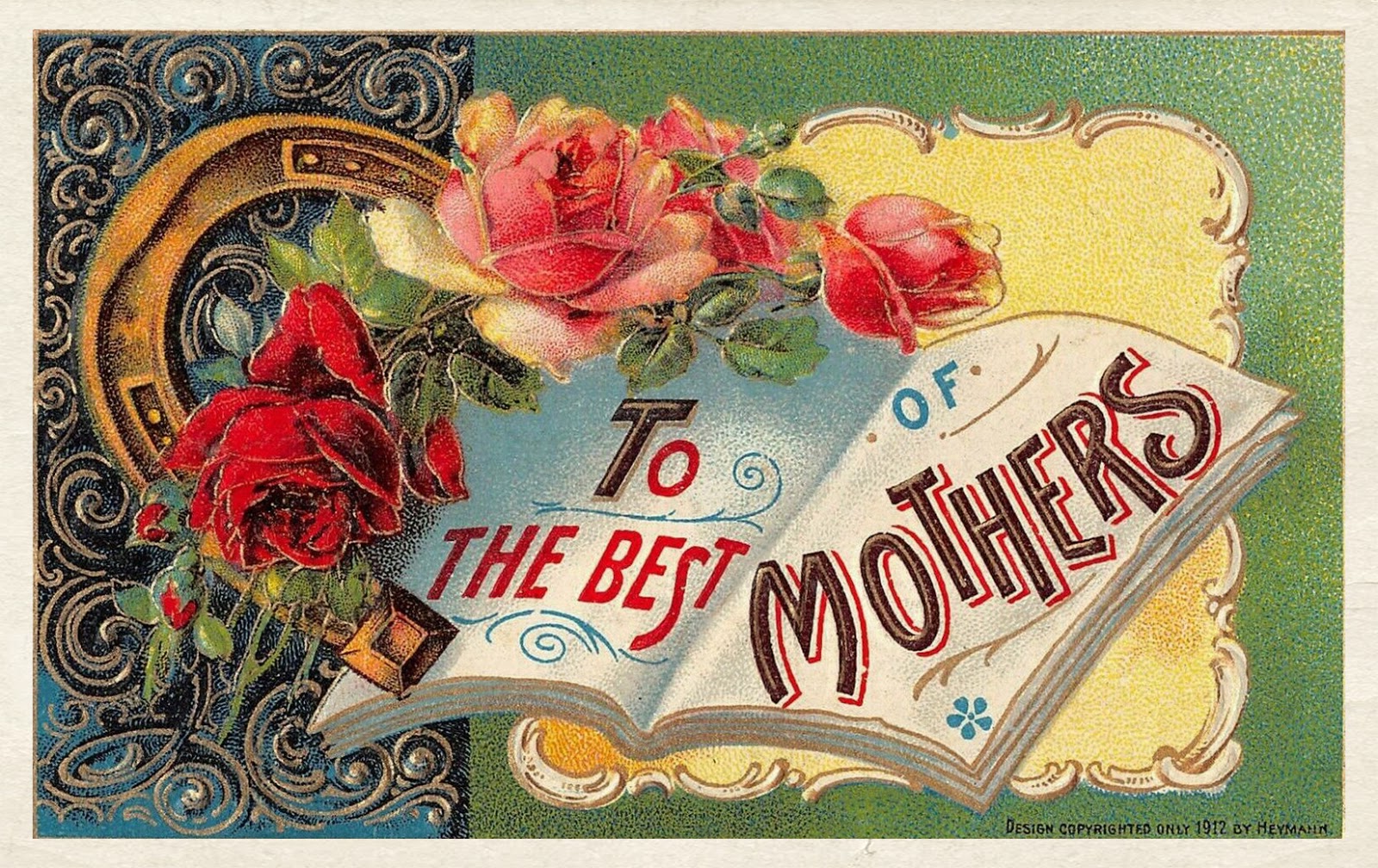
We're sharing some vintage postcards for Mother's Day. The symbol of the anchor is particularly interesting here, not something you often find on a card for a mother. But it is so appropriate – the anchor is a symbol of strength, stability, safety, security. These are certainly the traits associated with motherhood.
Happy Mother's Day!
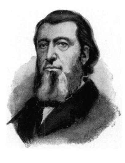
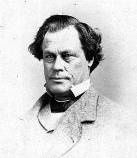
The Ridge Historical Society is wrapping up Presidents Day with a look at some of the connections between Abraham Lincoln and the Ridge.
The Illinois slogan is "Land of Lincoln." Although Lincoln was born in Kentucky in 1809 and spent much of his youth in Indiana, it was in Illinois, where he moved in 1830, that he became a self-taught lawyer practicing out of Springfield, became active in politics, and was elected the 16th President of the United States in 1860. He was assassinated in 1865, and his remains were brought back to Illinois for burial.
Lincoln traveled the legal circuit on his horse, Old Bob. With certainty, he rode through the Ridge on the Vincennes Trail on his many trips to Chicago. He came to Chicago often for legal business, social interaction, and most importantly, politics.
Three of the people from the Ridge that were in Lincoln’s circle were Ebenezer Peck, Austin Wiswall and Charles Ten Broeke. See the accompanying pictures for their connections.


From the Ridge Historical Society: The Chicago Tribune has an article today about a charming historic building in Lincoln Park now destined for demolition. Every time this happens, we lose a little piece of history.
Many historic buildings in Beverly/Morgan Park fell to the wrecking ball over the years, but there is one example of "adaptive reuse" we can point to with pride – the saving of the Christian Science church and reading room on 103rd and Longwood Drive.
The Thirteenth Church of Christ, Scientist, was founded in Beverly in 1914. The congregation built an impressive neoclassical building in 1916. In 1940, the Reading Room was built on the corner just north of the church. Christian Science Reading Rooms are bookstores and quiet places for study and prayer.
The congregation dwindled with time, and by the late 1980s, the church was barely being used. A creative solution for repurposing the church was suggested: converting the interior into condo units. In 1992, the Bell Tower Loft Condominiums went on the market. The external façade of the building was preserved.
The congregation continued the Reading Room for over another decade, remodeling it to also use as a church. In 2006, the building was sold, and now there is a Starbucks coffee shop on site. The interior was remodeled but the exterior retains the original look.
This is the Tribune article about the building closing in Lincoln Park: https://www.chicagotribune.com/columns/mary-schmich/ct-met-schmich-dairy-teardown-20200513-ay6x45og3bejlgme3zjeertmbu-story.html?fbclid=IwAR2MS9KYKEfjy0K6WtReXFgapl8iQy6bG0AGZzpA2ksMhhQMHqtBnd2QM_4
The attached pictures are of the church-turned-condos and the reading room-turned-coffee shop at 103rd and Longwood Drive.
May 6 to 12 was National Nurses Week, and the Ridge Historical Society did not forget about nurses! One recent history story we posted included the role of nurses in caring for patients during the influenza epidemic in 1918. Nurses bravely went into the homes of quarantined patients to help families care for their sick, plus assist with other domestic tasks, risking illness themselves.
We've also been doing research on some of the earliest nurses on the Ridge – those from the U. S. Civil War era.
Nursing as a profession was in its infancy then, and there were no formal nursing education programs. In fact, there were not even many hospitals – only about 150 in the country.
Thousands of women served as nurses during the U. S. Civil War. At first, women were considered too delicate to be able to withstand the conditions of tending to the sick and wounded, but they soon proved themselves through their determination, hard work and sacrifice.
Women started as volunteers, but thanks to the efforts of Clara Barton, a U.S. Army corps of nurses was formed in 1861. They were paid 40 cents per day for their service. (Male nurses were paid many times that, more than $200 per month.)
The nurses who "enlisted" came from many backgrounds: soldiers’ wives who had accompanied their husbands to military camps, local residents from the areas where camps were set up, religious institutions, and relief organizations. Not only did they deal with the injured, they also cared for patients with pneumonia, typhoid, dysentery, and malaria. Two-thirds of the deaths in the Civil War were from disease, not injury.
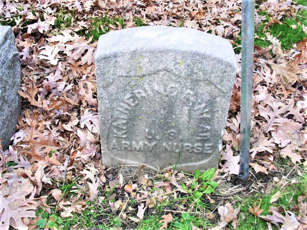
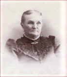
The graves of two nurses from the Civil War have been found in Ridge cemeteries. Mount Greenwood Cemetery includes the grave of Catherine E. Near. (Her name is spelled as Katherine on the stone; she went by Kate.) She was from Blue Island, and she died in 1908. Her maiden name was Fay. Her brother was Jerome Fay, of Fay's Point in Blue Island.
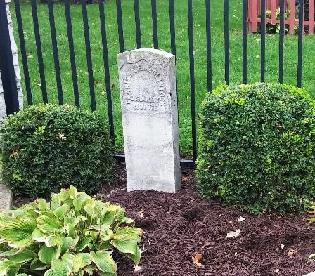
At the entrance to Memorial Park on 127th Street in Blue Island is a display of old tombstones dating back to the days when the park was the Blue Island Cemetery. One of the stones belonged to Clarissa F. McClintock, U. S. Army Nurse. Her background is being researched.


From the Ridge Historical Society: Rain, rain go away. The folks in Beverly want to play … and clean up their flooded basements.
Water comes with the geology of the area. Chicago is built on the bed of an ancient inland sea. Think of Chicago as sitting in a natural basin, sloping up on three sides to the rims of the basin. Lake Michigan is the fourth side. When water is poured into the basin, the basin fills, until it drains off to the lake or it evaporates. Chicago is above sea-level, but not by much, only 575 feet at its lowest point downtown by Lake Michigan. This, of course, is an overly simplistic description of the “water situation” of Chicago and there are many resources available to learn more about this fascinating topic.
Here on the South Side, about 12,000 years ago, an ancient island rose out of prehistoric Lake Chicago, called the Blue Island. The hilly ridge that runs along Longwood Drive was formed by the waves that lapped against the east side of the island. Lake Chicago eventually receded to the east, forming Lake Michigan, leaving behind the table of land known as the Blue Island Ridge or “the Ridge,” which is the highest elevation in the city, about 675 feet.
To the east of the Ridge, before development, the land was a vast system of wetlands and prairies all the way to the lake, punctuated by some forested areas where the land was higher in elevation – some smaller ridges. The animals – deer, wolves – knew by instinct to stick to the higher ground and wore trails into the terrain. The Native Americans used these trails, and then white trappers and traders, and finally settlers. These became the early “roads” – like the Vincennes Trail that ran from Chicago south through the Ridge before turning east into Indiana.
Early histories of the area gave vivid descriptions of what the natural land was like when settlers first arrived. One of the most poetic descriptions came from personal accounts of the Barnard family, which settled on the Ridge in the 1840s.
Here are some excerpts from that writing:
Looking south from what is now 101st and Longwood, “the view between the hill and the ridge where the Dummy Track now runs [today’s Metra line], was a slough in which the waters seldom dried up even in midsummer, and the greater part of the season was difficult to cross. Conclusive of this fact it is stated, a sandhill crane, as late as in the [1860s], built her nest for several years between Uncle Erastus’ house [104th and Wood] and the site of the Tracy depot [103rd and Wood], unmolested. No one would wade out after the eggs. Also, when he fenced his farm, the corner of Wood and Belmont Avenue [107th Street] was left without fencing, the water there being so deep that the cattle would not cross…. This slough was covered with a growth of coarse grass edged by high weeds. The weeds were thickest for two or three rods [a rod is 16.5 U.S. survey feet] just under the bluff, especially where the ravines poured their waters into the lowlands. Here, in autumn, wild artichokes, wild sunflowers, and iron weed waved their yellow flowers high above the heads of the tallest men. The ravine opposite Mr. Hauke’s was known as Horse Thief Hollow. Here horse thieves utilized their friendly shade as a hiding place.”
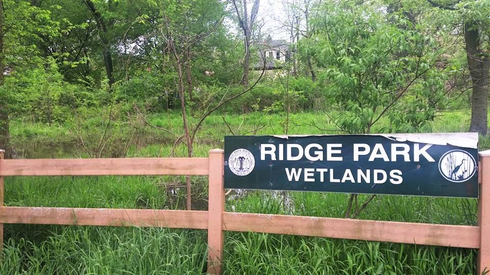
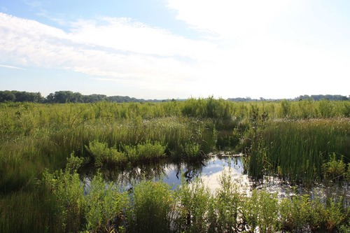
What this is telling us is that about 150 years ago, all that land from Longwood Drive east and south from about 101st Street was a vast slough, or wetland, that never dried up. The prairie and wetlands extended to the north and east of the Ridge also, but were less dramatic. The Ridge Park Wetlands between 95th and 96th Streets just west of the Metra tracks give a tiny inkling of what the area looked like back then. Right now, they are swollen with water from the recent heavy rains.
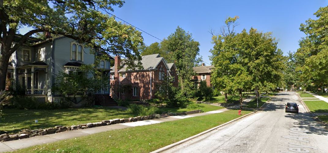
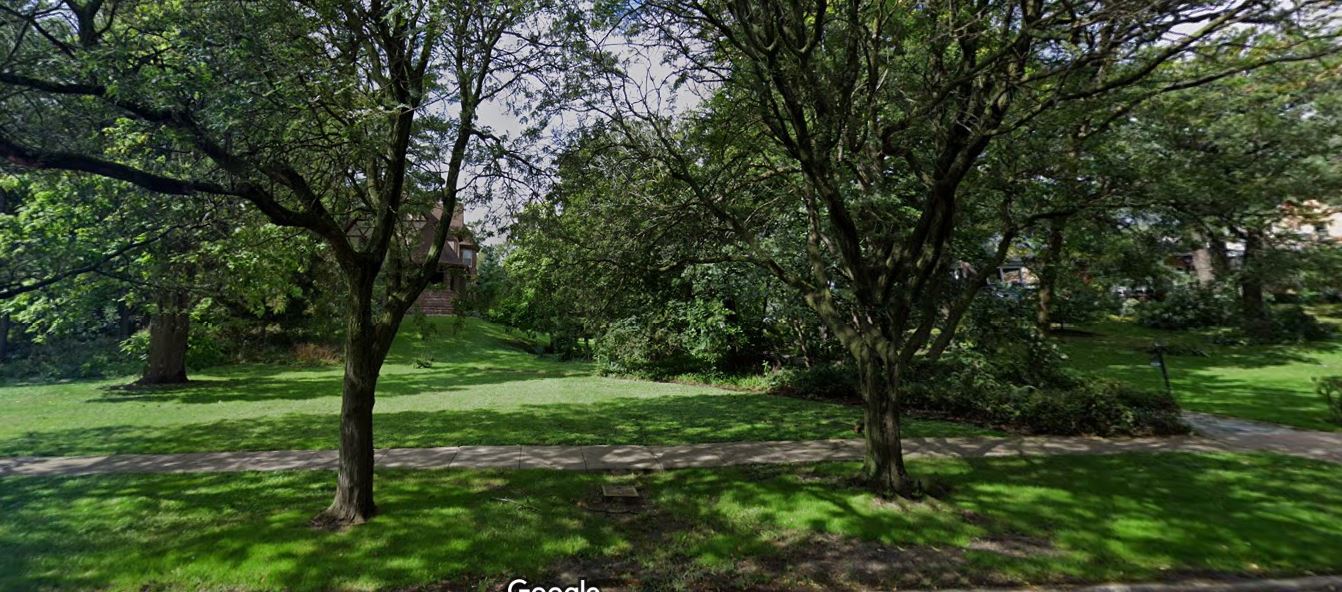
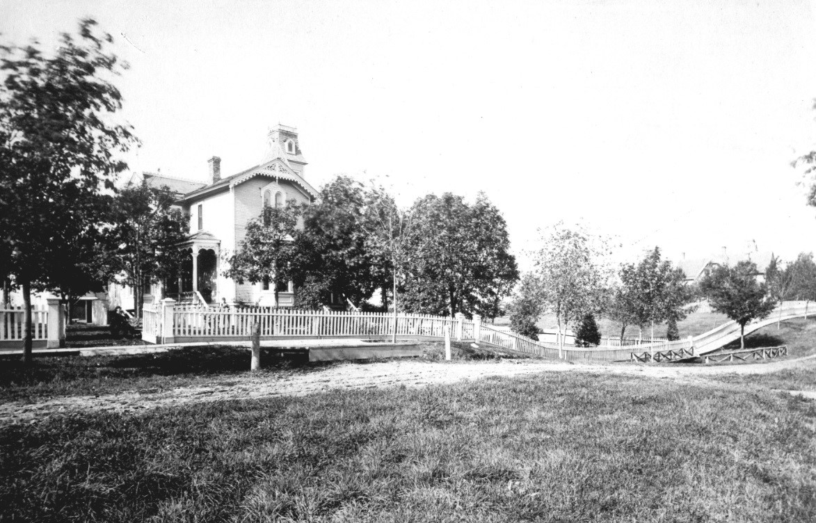
Streams that cut through the Ridge poured their waters into this land to the east. An early photo shows the charming George Chambers House, built in 1874, at 10330 S. Seeley Ave. In the picture, there is a bridge over a substantial stream that flowed down into the wetlands.
This house still stands, and there is a steep dip in the street where this stream was. You can see this ravine between the houses on Longwood Drive. This stream is likely still there, underground, heading southeast.
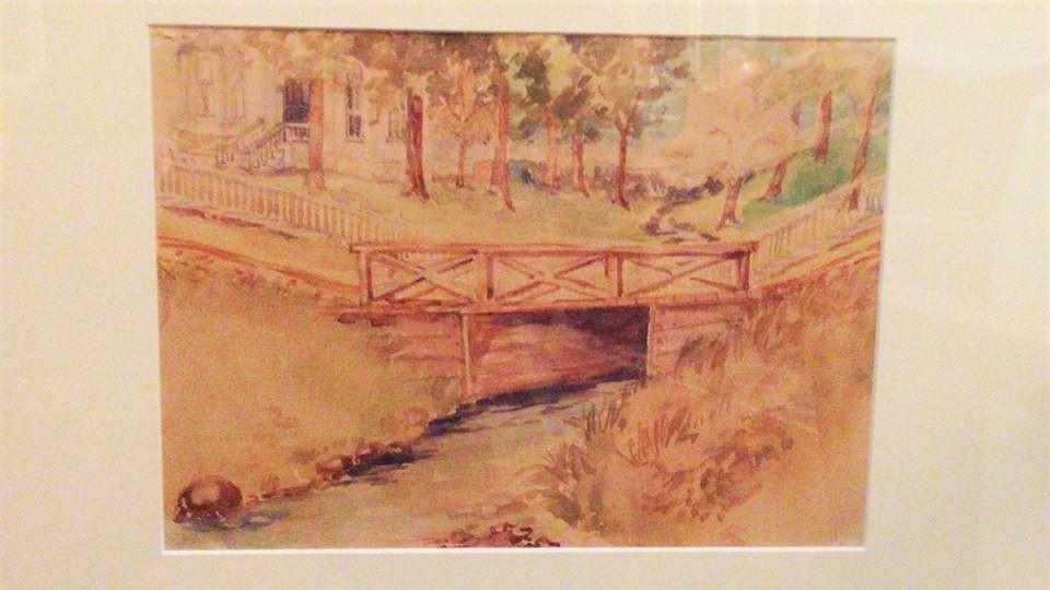
Louise Barwick, an artist who lived in that house around 1900, painted a watercolor of that stream and bridge, and the painting is in the RHS collection.
The bottom line of this story: Houses built to the east of the Ridge are built on natural wetlands. With heavy rainfall, this becomes all too evident.
As far as the reference to Horse Thief Hollow, the exact location of Mr. Hauke’s house has not been identified, but it was likely around 108th Place. There was a very deep ravine here, and early histories that identified a certain ravine as the place where evidence of horse thieves hiding out was found are likely referring to this location. The entire area was known as Horse Thief Hollow in the 1830s -1840s, but that is a topic for another day.
Part II will share more of the Barnards’ descriptions of the natural environment of the Ridge areas. Stay tuned.


From the Ridge Historical Society, Part I: Rain, rain go away. The folks in Beverly want to play … and clean up their flooded basements.
Water comes with the geology of the area. Chicago is built on the bed of an ancient inland sea. Think of Chicago as sitting in a natural basin, sloping up on three sides to the rims of the basin. Lake Michigan is the fourth side. When water is poured into the basin, the basin fills, until it drains off to the lake or it evaporates. Chicago is above sea-level, but not by much, only 575 feet at its lowest point downtown by Lake Michigan. This, of course, is an overly simplistic description of the “water situation” of Chicago and there are many resources available to learn more about this fascinating topic.
Here on the South Side, about 12,000 years ago, an ancient island rose out of prehistoric Lake Chicago, called the Blue Island. The hilly ridge that runs along Longwood Drive was formed by the waves that lapped against the east side of the island. Lake Chicago eventually receded to the east, forming Lake Michigan, leaving behind the table of land known as the Blue Island Ridge or “the Ridge,” which is the highest elevation in the city, about 675 feet.
To the east of the Ridge, before development, the land was a vast system of wetlands and prairies all the way to the lake, punctuated by some forested areas where the land was higher in elevation – some smaller ridges. The animals – deer, wolves – knew by instinct to stick to the higher ground and wore trails into the terrain. The Native Americans used these trails, and then white trappers and traders, and finally settlers. These became the early “roads” – like the Vincennes Trail that ran from Chicago south through the Ridge before turning east into Indiana.
Early histories of the area gave vivid descriptions of what the natural land was like when settlers first arrived. One of the most poetic descriptions came from personal accounts of the Barnard family, which settled on the Ridge in the 1840s.
Here are some excerpts from that writing:
Looking south from what is now 101st and Longwood, “the view between the hill and the ridge where the Dummy Track now runs [today’s Metra line], was a slough in which the waters seldom dried up even in midsummer, and the greater part of the season was difficult to cross. Conclusive of this fact it is stated, a sandhill crane, as late as in the [1860s], built her nest for several years between Uncle Erastus’ house [104th and Wood] and the site of the Tracy depot [103rd and Wood], unmolested. No one would wade out after the eggs. Also, when he fenced his farm, the corner of Wood and Belmont Avenue [107th Street] was left without fencing, the water there being so deep that the cattle would not cross…. This slough was covered with a growth of coarse grass edged by high weeds. The weeds were thickest for two or three rods [a rod is 16.5 U.S. survey feet] just under the bluff, especially where the ravines poured their waters into the lowlands. Here, in autumn, wild artichokes, wild sunflowers, and iron weed waved their yellow flowers high above the heads of the tallest men. The ravine opposite Mr. Hauke’s was known as Horse Thief Hollow. Here horse thieves utilized their friendly shade as a hiding place.”
What this is telling us is that about 150 years ago, all that land from Longwood Drive east and south from about 101st Street was a vast slough, or wetland, that never dried up. The prairie and wetlands extended to the north and east of the Ridge also, but were less dramatic. The Ridge Park Wetlands between 95th and 96th Streets just west of the Metra tracks give a tiny inkling of what the area looked like back then. Right now, they are swollen with water from the recent heavy rains.
Streams that cut through the Ridge poured their waters into this land to the east. An early photo shows the charming George Chambers House, built in 1874, at 10330 S. Seeley Ave. In the picture, there is a bridge over a substantial stream that flowed down into the wetlands.
This house still stands, and there is a steep dip in the street where this stream was. You can see this ravine between the houses on Longwood Drive. This stream is likely still there, underground, heading southeast.
Louise Barwick, an artist who lived in that house around 1900, painted a watercolor of that stream and bridge, and the painting is in the RHS collection.
The bottom line of this story: Houses built to the east of the Ridge are built on natural wetlands. With heavy rainfall, this becomes all too evident.
As far as the reference to Horse Thief Hollow, the exact location of Mr. Hauke’s house has not been identified, but it was likely around 108th Place. There was a very deep ravine here, and early histories that identified a certain ravine as the place where evidence of horse thieves hiding out was found are likely referring to this location. The entire area was known as Horse Thief Hollow in the 1830s -1840s, but that is a topic for another day.
Part II will share more of the Barnards’ descriptions of the natural environment of the Ridge areas. Stay tuned.
From the Ridge Historical Society:
Part II – On the “natural history” of the area around the Ridge.
Yesterday we talked about the prairie wetlands to the east of the Ridge. Here are a few more descriptive comments from the Barnard family, who settled here in the 1840s:
“On the place just west of our present school house [likely just northeast of 103rd and Vincennes] jointed blue grass and pea vine grew together and were so dense and thickly interlaced that snakes ran along the top of them.
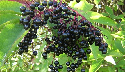
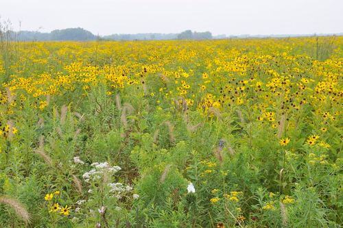
“Where the fires had swept the ground clean of the course growths the more delicate varieties of prairie flowers, phlox, shooting stars, violets, etc., literally covered the earth with varied and beautiful flowers as the grass covers with green, a profusion of bloom of which we have no adequate conception. The orchid family was represented by several varieties of lady slippers, of which great masses showed their pink and white or yellow heads under the trees at the edge of the groves. Wild fruits were abundant. West Pullman was then a huckleberry patch [similar to blueberries, see picture]. Wild strawberries grew thickest on the prairie east of Prospect…. Blackberries were thick on almost all of the ridges. Plums were plenty. Hazelnuts were found, but the hickory trees were too small to bear the abundant supply which we enjoyed in our childhood.”
These descriptions conjure up images of a Garden of Eden, from abundant fruits to snakes.
But there was a dark and dangerous side to paradise, also. Another quote from the same paper:
“Stagnant water and the breaking up of the new soil made prevalent the fever and ague. Many families still talk of all being sick at one time and of retiring to bed with a pitcher of water to quench the thirst which was sure to come and to which no one would be able to administer. Chills every day for a whole year were not infrequent experiences.”
The “ague” was another name for malaria. Stagnant water led to mosquitoes breeding, and mosquitoes can carry plasmodium parasites, which cause malaria. Symptoms are bouts of chills, fever, and sweating. The parasite can live and reproduce in the host body, leading to the cycle repeating for some time. There was no understanding back then that the illness was borne by mosquitoes, no understanding of parasites, and no treatment. It was a common cause of death.
As far as drinking water, the area was noted for Artesian wells – deposits of groundwater from which water flows under natural pressure without pumping. Artesian wells were all around the Chicago area, and the topic is too complex to get into in detail here, but well worth exploring. (Everything about the history of the Chicago region is worth exploring.)
One more entry from the Barnard paper, which mentions one of these wells, describes settlers from Indiana and downstate Illinois travelling the Vincennes Road in their “prairie schooners” or covered wagons, bringing their produce to market in Chicago. Long trains of the wagons passed by the Ridge from morning to evening.
Wrote Barnard: “When night time came, their camp fires glowed in the darkness. Near grandmother’s house where they could enjoy the water from her excellent well was a favorite camping ground, and one of the diversions of the family was to visit the campers in the evening.”
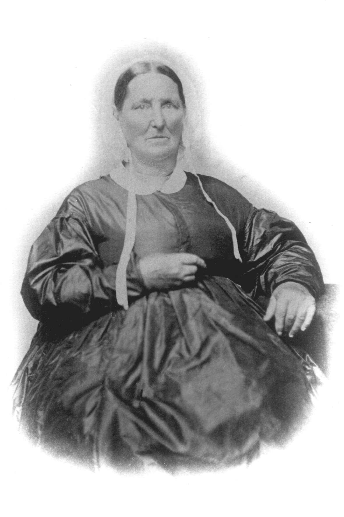
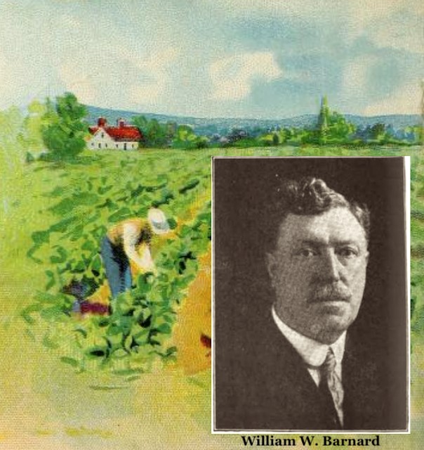
The author of this paper was William Wilcox Barnard (1856-1921). He was third generation on the Ridge.
His grandmother was Sarah Lord Wilcox. The Wilcoxes came from New York and took over the Gardner Inn on the Vincennes Road in 1844. It was located about where 100th St. and Beverly Ave. are now. Her daughter Miranda Wilcox married William Barnard, who had come to the Ridge to be the tutor for Thomas Morgan’s children. William and Miranda’s children included William Wilcox, or W.W., as he was known. W.W. started the Barnard Seed Co., which farmed the area around at 103rd and Longwood Drive.
Here are pictures of W.W. and his grandmother, from the RHS collection. By the way, smiling in pictures did not become standard until the 1920s-30s. For us now, the natural response is to say "cheese" as soon as a camera points our way, but that was not an instinctive reaction back then. Some people theorize that it was due to poor teeth or having to hold still for too long for the picture to take, but that was probably not the case. It just wasn't the norm back then.
In Part III, we’ll discuss a few more topics, like prairie fires and wildlife, and then answer some of the questions that have come in from these posts.
– Carol Flynn, RHS Communications


From the Ridge Historical Society
Part III on the natural history
– Carol Flynn, RHS Communications
This is a continuation of W.W. Barnard’s history paper, which was a reminiscence written in 1894 of 50 years before, based on the stories he heard from family members.
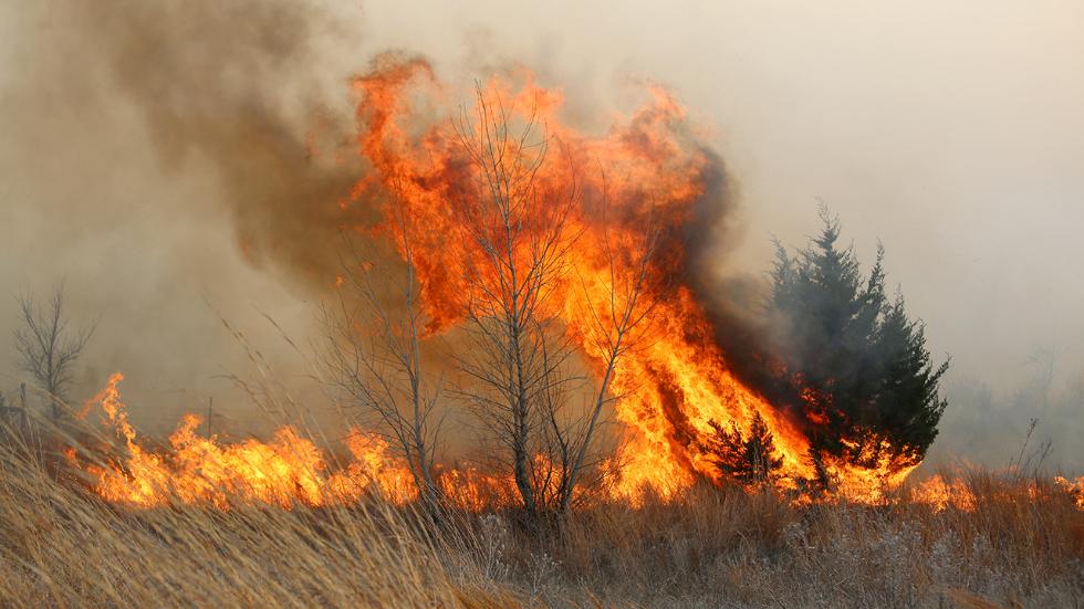
“Prairie fires were very frequent and much dreaded. In the afternoon of an autumn day of 1845 our family had their first experience with a prairie fire. The oldest son was sick in bed with the ague [malaria]. Grandmother with her four younger sons and 14 year old daughter went out to fight the flames, but Mary who was too small to help, remained at home, carrying water to her brother watching the fire. As she looked to the west and south she heard loud roaring and saw flames running 10 to12 feet high where they reached the tall weeds and extending as far as she could see. Eagerly she watched the family who were fighting the flames. They had nothing with which to plow and they could only set backfires and whip it with wet bags and brush. They fought heroically but were continually obliged to retreat. Nearer and nearer the house it came, but at last, when it came to the low grass only a few rods from the door the fighters conquered.”
In explanation, by late summer, the prairie grasses grew as tall as eight to ten feet high, and dried out as their growing cycle ended. This was the “dry season” which saw much less rain.
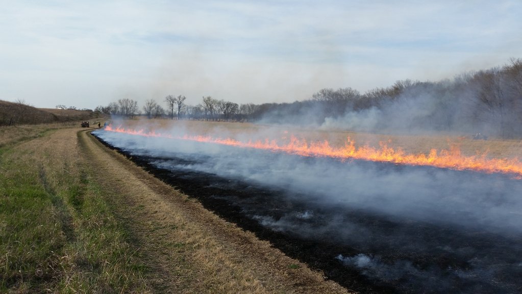
Fires started by various means, including lightning strikes and sometimes by the sun refracting off glass or metal left by wagons passing through. The Indians used controlled burning to aid in hunting. But many of the fires resulted from settlers’ carelessness or accidents, such as campfires and cooking fires that got out of control, ashes from a pipe, or sparks from a chimney. Once a fire started, it could spread very quickly.
Prairie fires benefit the ecosystem by burning off old growth and allowing renewal, however, they were very dangerous for the people settling in the area.
Barnard further tells us:
“It was the custom to plow around the houses and stacks [of hay] for protection against these fires. Sometimes two circles were plowed and the grass between them burned off, thus an effectual barrier was made. Dr. Egan, one of the early doctors of Chicago, asked one of the farmers the best way to protect his stacks from fire and was told to plow around the stacks and burn between. He followed the instructions by plowing several times around the stacks and then burning between them and the stacks, which resulted in his burning up his own hay.”
Perhaps there is a lesson here – maybe Dr. Egan should have stuck to doctoring and hired someone knowledgeable about the firebreak process to do the burning.
In the earliest years, wildlife was abundant. Deer was the largest prey and wolves the largest predators, although an occasional lynx or panther [cougar] or black bear was spotted that had wandered in from the more remote and wilder Palos area. Prairie chickens, pigeons, quail, rabbits, squirrels, raccoons, etc., kept tables well supplied with game.
Flocks of millions of passenger pigeons darkened the skies. This was once the most abundant bird in North America. Hunting, and deforestation which resulted in loss of habitat, led to the species becoming totally extinct by the early 1900s. A picture of a mounted passenger pigeon in the Field Museum of Natural History is attached.
To the south, the Calumet River, and Stony Creek at the tip of the Ridge, had plentiful fish. Beaver, otters, mink and muskrats were abundant in the many sloughs that covered the area but were soon trapped out. Every fall wild rice beds in the sloughs attracted thousands upon thousands of water fowl. The reeds and cattails were taller than men. Hunting in the sloughs was dangerous; it was easy to get lost and mired in the mud. Many years, hunters disappeared.
The “Morgan Boys,” as W.W. Barnard’s uncles always called Thomas Morgan’s sons, kept a pack of greyhounds, which their father had brought over from England on his private ship. They led hunting parties to bring down deer. Hunting parties also chased down the wolves. The women of the pioneer families rode on these hunts, and many of them were better horsemen and shooters than the men.
The settlers shared the prairie with the wolves. Barnard wrote, "At night the howl of the wolf filled the air, but this occasioned no alarms." The wolves generally left the humans alone, although there are some stories of hungry wolf packs killing lone humans, especially during winter. Livestock was another matter. Settlers killed off the wolves to protect their valuable cattle. A picture of timber wolves, also called gray wolves, is attached.
Today, a number of foxes are evident in the area. They probably would not have been here much back then, they would have avoided any area dominated by the much larger wolves. The same with coyotes. The eradication of the wolves in the mid-1800s allowed smaller predators to move into the area and take over the wolves’ natural niche.
Located south of Chicago is the Midewin National Tallgrass Prairie, a restoration of 20,000 acres of natural prairie and wetlands. A visit there shows us what the land around the Ridge looked like 150+ years ago when the first settlers moved in.
The next installment will answer some questions that have come in from these posts.