
Explore the RHS Facebook Archives, a rich repository of local history written by Carol Flynn. For two decades, Carol brought a deeply dedicated voice to public education at RHS. Her role as Facebook administrator through mid-2025 naturally extended her prolific research into meticulously detailed articles, most notably her multi-part historical series posts. Today, Carol continues her local history writing for The Beverly Review and other outlets.
2021
Ridge Historical Society
Happy Bastille Day
July 14, 2021
By Carol Flynn
Today is Bastille Day, the National Day of France. It is the anniversary of the Storming of the Bastille in 1789, a major event of the French Revolution, as well as the Fête de la Fédération that celebrated the unity of the French people in 1790.
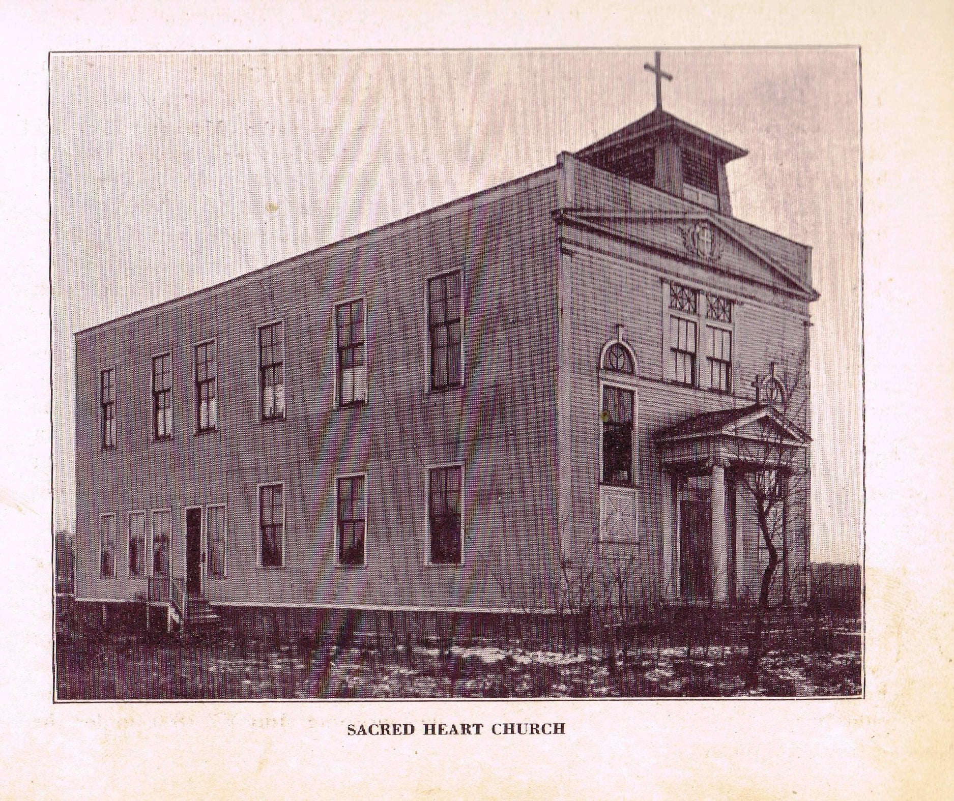
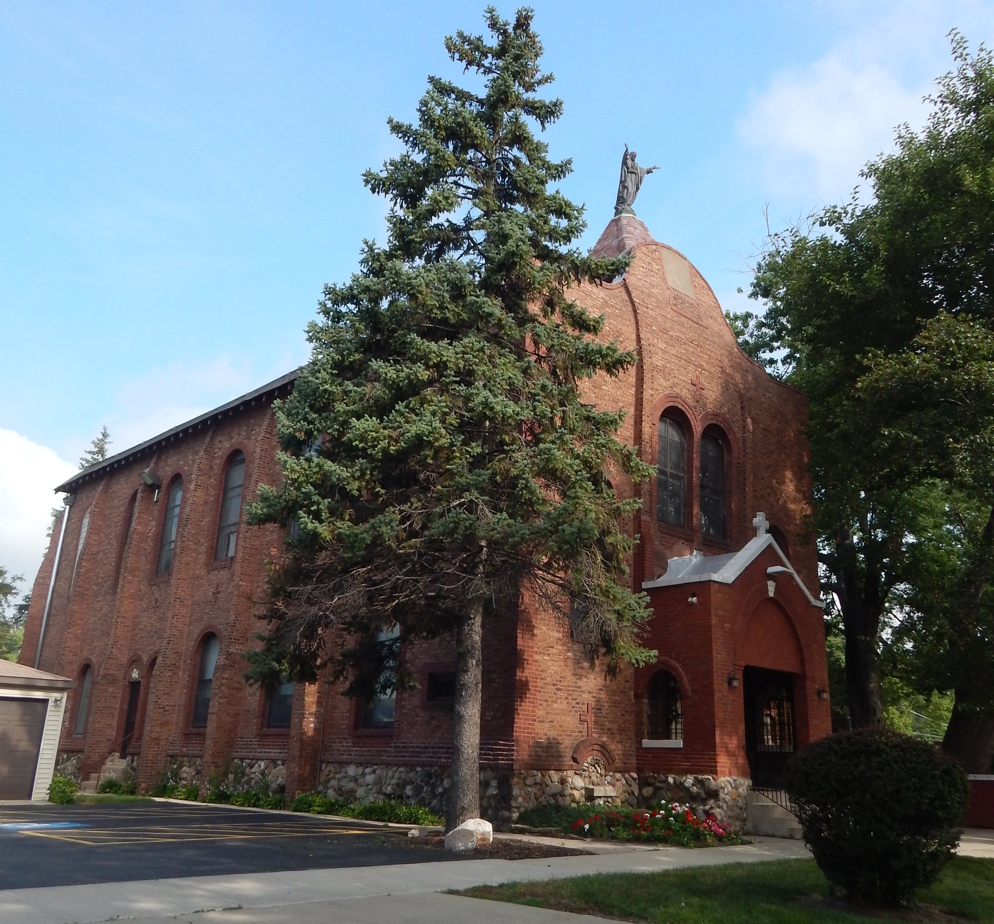
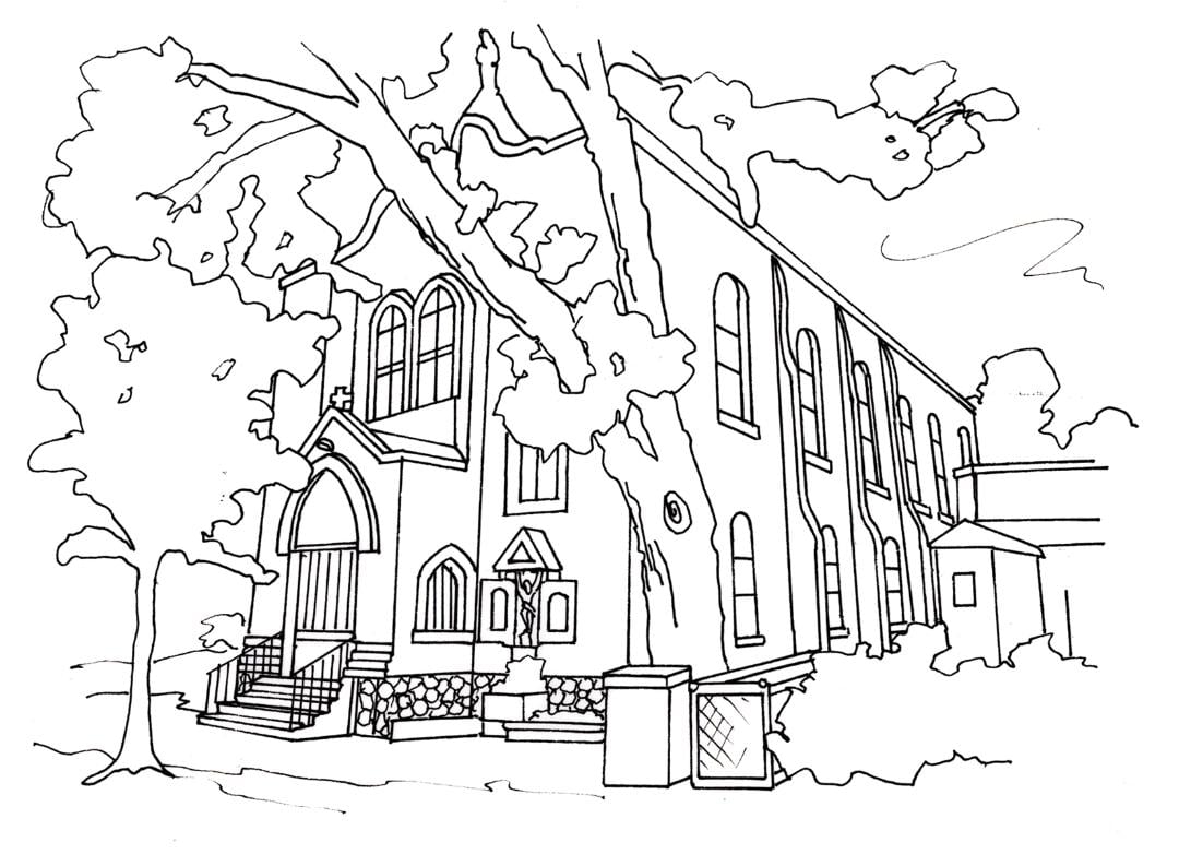
The Blue Island Ridge has its own “French connection.” We had an early group of settlers here, and their legacy to the community is the historic and charming Sacred Heart Church at 11652 S. Church St.
Sacred Heart was originally founded in Alsip in 1892. After an unfortunate fire, the church moved to its current location to be closer to the Purington Brick Yards at 119th and Vincennes, where many of the French people worked. The current church was built in 1904-5 and originally appeared as a wooden frame church, built on posts in a swamp. The church was established as a “national church” which meant it would serve a particular nationality, not a defined geographic area. The story goes that the workers were allowed to take “seconds” of bricks from the brickyard, those bricks that were burnt in the ovens and therefore couldn’t be sold, over to the frame church one or two at a time. By 1922, when enough bricks had been saved, the present brick facade was added. The church as it stands now is actually the old frame church clad with this donated brick.
Father Raymond DeNorus, a missionary priest born in France, became pastor in 1912. From all accounts, he was a very charismatic man. He loved a good time, yet he was a man deeply devoted to his faith. He dispensed medicine, holy water and blessings from his side door. Numerous miracle cures were reported to have taken place over the years. Crutches, canes and braces left abandoned at the church were hung on the side walls. Services at the church drew large crowds and it became a place for pilgrimages. During this time the church became known as the Shrine of the Sacred Heart, a shrine being a special place of devotion that attracts travelers from afar. Fr. DeNorus retired in 1935. With time, most of the French families moved on and were replaced by German and Irish workers.
In 1979, the Archdiocese of Chicago under John Cardinal Cody decided to close and demolish Sacred Heart, citing as its main reasons a shortage of priests and the expense of construction needed to correct building code violations. Members of the congregation rallied to restore and preserve the church. The church was closed from 1979-1982. But then Cardinal Cody died, and the new Archbishop, Joseph Bernardin, agreed to review the matter. He reopened the church and celebrated Mass there in 1983. The church was reestablished as a "mission church" operating as part of the Holy Name of Mary Parish in Morgan Park. Francis Cardinal George also visited Sacred Heart. He was so charmed by the church he even said he would like to live there when he retired.
The devotion to the Sacred Heart of Jesus originated in France in the late 1600s when a nun, Saint Margaret Mary Alacoque, claimed that during a series of apparitions, Jesus promised certain blessings to those who practiced devotion to his Sacred Heart. The Vatican’s position is that the manifestation and promises are true. So the name Sacred Heart was very fitting for a French mission church.
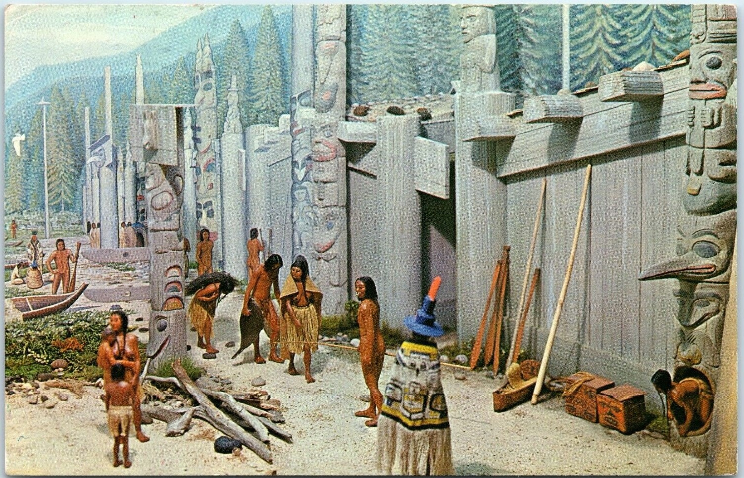
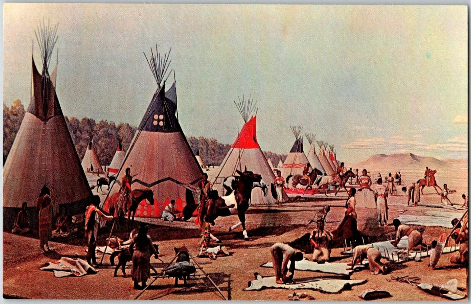
Native Americans and the Blue Island Ridge – Part 9Lifestyle of Calumet Region Indians
There are many sources available for information on the history of Native Americans, and anyone interested in the topic is encouraged to never stop seeking out additional information and new viewpoints.
The actual lifestyles of the Native Americans who lived in the Calumet Region, of which the Blue Island Ridge formed the western boundary, from the 1600s to the 1800s will be the focus of the next few RHS posts. The major references for this are a resource from the University of Chicago titled “Historic Native Americans of the Calumet Region,” which was produced in 2014, and resources from current Native American websites and writings.
The Calumet region long served as the home for tribes that were part of the Algonquian language group and were connected through their heritage and interactions which each other.
The Algonquian are one of the largest and most widespread of the Indigenous groups, prominent along the Atlantic coast, the Saint Lawrence River, the Great Lakes, the Mississippi River, and the Great Plains.
The Algonquian languages included about thirty related languages, presumedly descended from an unknown common language spoken about 3,000 years ago. The term “algonquin” is derived from an Indian term meaning “they are our relatives and allies.” Many of the Algonquian languages are extinct now, or severely endangered.
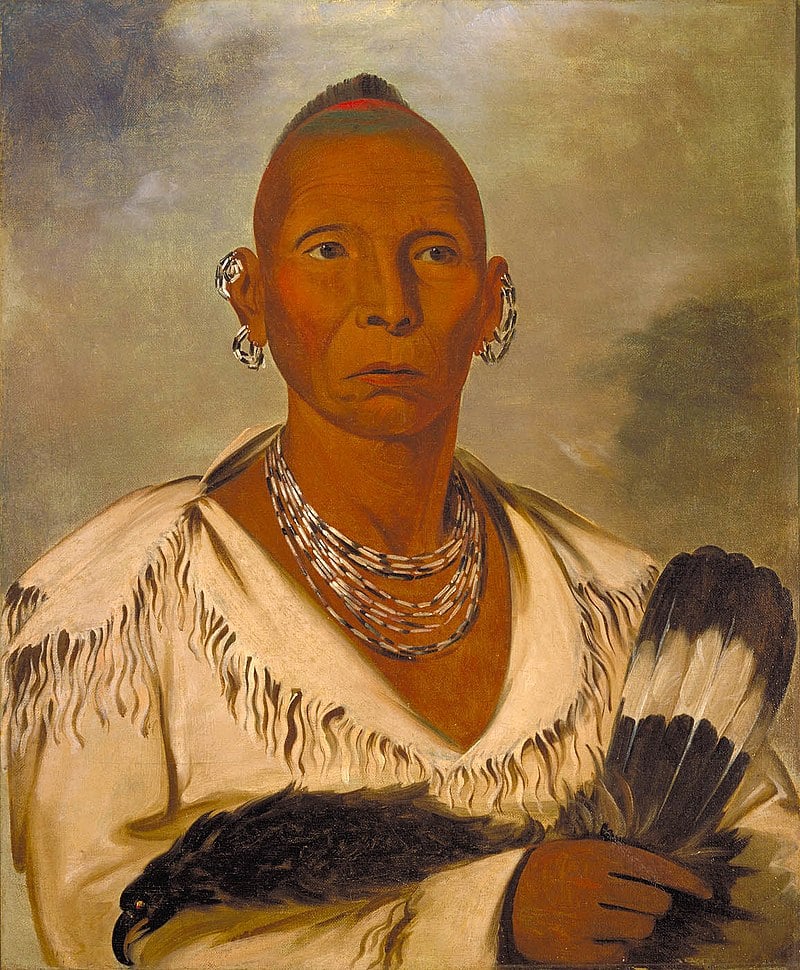
The primary inhabitants of the Calumet region area were the Miami and Potawatomi. Within the Algonquian language family, the Potawatomi are part of the Anishinaabe group, which includes the Ojibwe and the Odawa. By the late 1700s, most of the Miami had moved into the Indiana area and out of the Chicago area, leaving the Potawatomi as the prominent inhabitants.
Through trade and seasonal migration, other tribes that had a presence included the Illinois Confederation, a group of more than a dozen tribes that included the Peoria, Kaskaskia, and Cahokia tribes.
Other tribes with a presence in the area included the Ojibwa and Ottawa, which formed the Council of Three Fires with the Potawatomi; and the Mascouten, Sauk, Winnebago, Kickapoo, Shawnee, and Wyandot, all with lands around the Great Lakes and northern Illinois areas, and all considered “neighbors” of the Indians who lived in the Blue Island Ridge area.
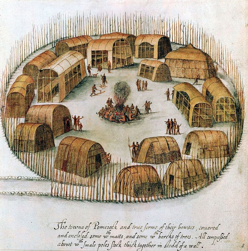
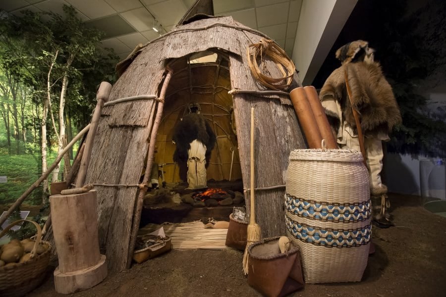
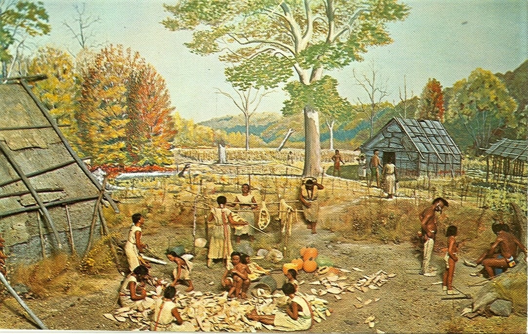
The Native Americans of the Calumet region lived in villages ranging from a dozen to hundreds of lodgings. Specific structures included longhouses and wigwams, and eventually log cabins. Although architecture was not uniform, buildings were constructed of a pole frame covered by large sheets of elm or birch bark or rush mats. A longhouse could accommodate multiple families, while a wigwam or log cabin was usually used for a single family.
Villages served as the home base for the tribe, but they were not fully occupied all year round. Summer was the time the villages were most full, during the agriculture season of cultivating and harvesting crops and native plants. By fall, the village would split into smaller groups for winter hunting, spring sugar making, and fishing, before returning to the village the next summer.
The different tribes had different government structures. Some were largely centralized under one chief, but even that chief might not have actually had that much decision-making power. The chiefdom was not passed down as a birthright. The chief was usually selected based on battlefield success and ability.
The Potawatomi practiced a more decentralized, localized government organization than other Algonquian tribes. There were many groups largely autonomous throughout the tribal territory, and the chief of each of these groups had considerably more political power than chiefs of local groups of other tribes. Leaders were chosen from among the tribe members, based on success during hunting or warfare. The leader of the group had the ultimate say in the group, and was responsible for quick decisions in hunting or raids, and paying reparations or seeking revenge for any deaths that occurred. He would lose his leadership position with lack of success with hunting or war, or with losing members during expeditions.
Within tribes, the “medicine” men and women were feared and respected, and influenced decision-making. These were the traditional healers and spiritual leaders of the group. This created a power hierarchy in which age brought respect and influence into the daily life of the group. As with most groups of people, religious and spiritual beliefs of the tribes greatly affected how they perceived the world around them.
In the next posts, we will look at spiritual beliefs, clothing, food, pastimes, and gender roles of the Indian groups in the Calumet region.
Hooray! The Ridge Historical Society passed a milestone today! We reached 2,000 Followers! Thank you so much for your support!! We absolutely LOVE bringing local history to the community!
I hate to beg, but the Ridge Historical Society has 1,999 Followers. You see where this is going. If you enjoy this page, could you please "Follow" us to satisfy my OCD leanings? Thank you! – Carol Flynn, RHS Public Outreach Coordinator

The Ridge Historical Society extends its sincerest condolences to the family and friends of long-time Morgan Park resident Bill Barnhart who passed away in Florida on July 3.
Bill Barnhart, 74, was known for his long career as an expert in financial markets with the Chicago Tribune, CLTV cable news, and other media outlets. In the Ridge communities, he was known as a friend and neighbor.
Bill loved history as much as finance – he and his wife Kate Eaton were supporters of RHS for many years. Bill not only made great use of the RHS collection for research and writing, he served as RHS President in the early 2000s.
In 2010, he published “John Paul Stevens – An Independent Life,” the biography of another famous Beverly resident, U.S. Supreme Court Justice John Paul Stevens. Bill gave a standing-room-only presentation and book signing at RHS.
Bill also published “Kerner: The Conflict of Intangible Rights,” in 1999, about the past Illinois governor whose notable achievements were eclipsed by his conviction and incarceration for tax evasion and other charges.
Bill Barnhart’s contributions were greatly appreciated and will be very much missed. May he rest in peace.
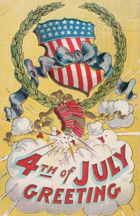
Happy Fourth of July from the Ridge Historical Society!
How did the residents of the Ridge celebrate one hundred years ago? According to the July 8, 1921 Englewood Times newspaper and our intrepid reporter Mrs. Pauline F. Palmer:
“The Ridge enjoyed a corking good Fourth and the field park and swimming pool at 97th Street and Longwood Drive was crowded all day. The baseball games and water sports attracted much attention. Many guests from adjoining suburbs were present and were pleased at the comfortable pleasures enjoyed by all.”
Mrs. Palmer is referring to the original Ridge Park, which was established in 1911 – 12. The architect John Todd Hetherington, who designed many fine homes in Beverly and Morgan Park, was a member of the Ridge Park commissioners. The board persuaded Hetherington to design the park. His creation included a small field house, outdoor swimming pool, running track and sports fields, surrounded by trees, shrubbery, flowers and walks.
In 1929, Hetherington, now in partnership with his son Murray D. Hetherington, designed the current field house, which enclosed the pool, and used the original fieldhouse as the auditorium.
And in case anyone thinks that porch and lawn concerts are anything new, because of the pandemic, that is not so.
Mrs. Palmer also reported that for the holiday one hundred years ago:
“About one hundred guests enjoyed the out-door street dance and sing at 94th Street and Pleasant Avenue, given by Miss Edna Wiggins of 9372 Longwood Drive on Tuesday evening. A four-piece orchestra furnished the music and the young people all enjoyed the novel way in which the party had been planned. Mr. and Mrs. A. B. Christian, 9300 Longwood Drive, and Mrs. Mitchell of Memphis, Tennessee, chaperoned the dance. Refreshments were served.”
Native Americans and the Blue Island Ridge – Part 8Relationship to the Land
This series is looking at the history of Native Americans on the Ridge in the context of developing Land Acknowledgement Statements, which are declarations recognizing that Indigenous Peoples lived on this land for thousands of years before the European settlers arrived.
As with every aspect of this topic, the relationship that Native Americans had with the land was complex. Indians were natural environmentalists, stemming from their spirituality. Customs and lifestyles varied from group to group, but in general, the Indigenous people considered the land and all things in nature as gifts from a sacred Creator being or force, and were grateful and humble for these gifts.
In this value system, humans were not masters of the natural world, but rather they were a part of the system like other animals and plants. There were mutual benefits for plants and animals to exist together in an environment. A human being did not exist separately from the air he breathed, or the water he drank, or the plants he ate, or the animals whose furs clothed him, or the bark of the tree that was used to make his canoe.
According to John Low, Ph.D., J.D., a professor at Ohio State University, who is an enrolled citizen of the Pokagon Band of Potawatomi Indians, and was interviewed by RHS:
“Our ancestors lived for thousands of years utilizing the resources around them and securing a balance in their use of the environment. Our traditional teachings emphasize that we are but one part of the Universe and that to live in balance with the other beings of the world we must live in a way that minimizes waste and honors the sacrifices that plants and animals make for our continued existence.
“Our songs, stories and spirituality all teach the ways for us to live in harmony with each other and the world around us.”
Comments from other Native Americans in the past support Dr. Low’s statements:
“Indians and non-Indians alike [must] see ourselves as part of the earth, not as an enemy from the outside who tries to impose its will on it. Because we … also know that, being a living part of the earth, we cannot harm any part of her without hurting ourselves.” – Lame Deer, Lakota medicine man
“The Great Spirit made the flowers, the streams, the pines, the cedars—takes care of them. . . . He takes care of me, waters me, feeds me, makes me live with plants and animals as one of them. . . . All of nature is in us, all of us is in nature.” – Black Elk, Lakota medicine man
Although their efforts were not perfect, the lifestyles of most Native American tribes were excellent examples of sustainability. Some tribes, like the Iroquois, were fierce hunters, but they respected their prey, such as deer and bison, and took care not to overhunt. Other tribes who relied on crops developed elaborate irrigation systems and other practices to keep the land fertile. They cut down trees sparingly.
There is a misperception that Native Americans did not understand the concept of land ownership or personal possessions. This is not true. Different tribes practiced different customs and some had very complex systems and rules concerning possessions.
They certainly established boundaries of tribal lands for hunting, fishing, and growing crops. Within tribes, while they considered the land to be a communal resource, they respected personal boundaries of homes and family plots and possessions. Possessions were something you could take with you – horses, clothing, food, tools, ceremonial items. You could not take the land and nature with you – therefore no one could really “own” it.
What European settlers considered an unsettled, nomadic lifestyle for some Indians was actually not aimless wandering at all. The Indians rotated their living arrangements among several preferred locations to take advantage of seasonal bounties for hunting and harvesting food plants. It was an environmentally efficient way to live. Rather than building permanent structures and fences, and trying to force the environment and land to conform to their needs and wants, they followed the seasons and the plentiful resources available at different places at different times.
Next: The life of the Native Americans in the Blue Island Ridge area.
Chicago Landmarks
Everyone will have their favorite landmarks in Chicago to go on a list like this one. And while I agree these are all interesting sites, not all of them would be in my top five.
These would be my choices:
Pullman Historic area – included in the list, definitely one of the most historically fascinating and important areas in the city.
The Chicago Water Tower at 806 North Michigan Avenue.
The Robie House by Frank Lloyd Wright at 5757 S. Woodlawn Avenue.
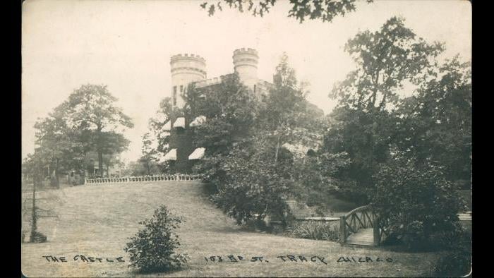
The Givins Beverly Castle at 103rd and Longwood Drive. This is the ONLY castle in the city!
The final one is up for grabs – there are so many interesting places to choose from. Cemeteries like Graceland or Oak Woods. Sculptures like Lorado Taft’s Fountain of Time. Lincoln Park or Grant Park or Jackson Park. The Cultural Center, the Tribune Tower, Sears (Willis) Tower. The old Stockyards Gate. The Haymarket monument. Buckingham Fountain. On and on.
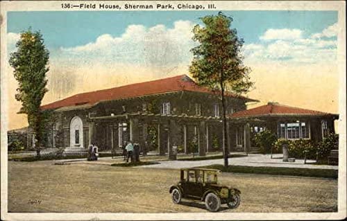
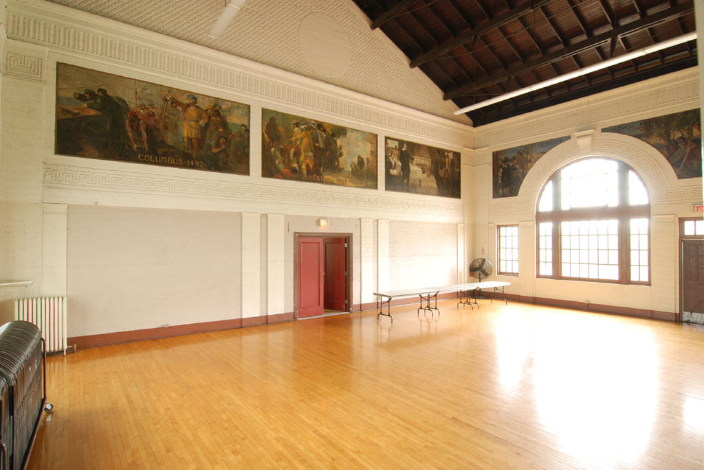
The original list includes a building in Garfield Park. A number of parks have very important old buildings. Sherman Park’s field house was designed by the famous Daniel Burnham. The park is named for Burnham’s father-in-law, John B. Sherman, the founder of the Chicago Union Stockyards. The landscaping was done by Frederick Law Olmsted. In addition, the Sherman Park field house also has priceless murals completed during the 1930s through the Works Progress Administration (WPA). (Sherman also owned much of the land that is now Dan Ryan Woods and used the land for an experimental stock farm. After his death, the land was eventually sold to Cook County for the forest preserves.)
I am not up on industrial design like the bridge they mention in this article, but there are numerous bridges and industrial design elements for people to choose from – I will let others comment on that.
https://kevsbest.com/landmarks-in-chicago/amp/?fbclid=IwAR2pDDA57BWfo9jsJ7QGZRZe1RODUcWADU3mynJNSi8pIcse-sMgKeEPRtU
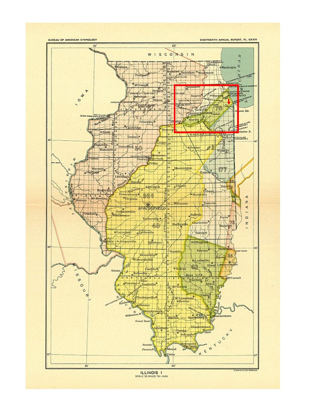
Native Americans and the Blue Island Ridge – Part 7The Calumet Region
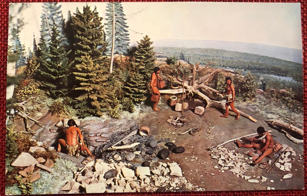
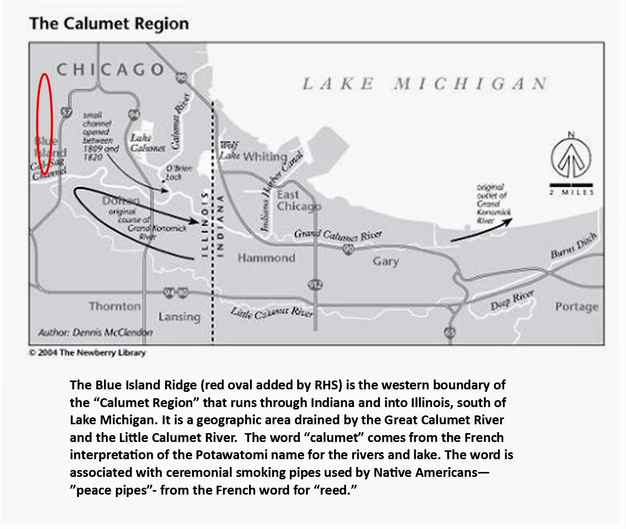
The Blue Island Ridge, a prehistoric landmass formed by glacier activity thousands of years ago, and the surrounding land, is part of the Calumet Region at the southern tip of Lake Michigan. The geography of the area made it important for Native Americans and later European settlers for several reasons.
First, there was an abundant supply of fresh water, and the area abounded with a natural diversity of plants and wildlife, especially during seasonal migrations. Included were buffalo and deer and many small species of game animals, and birds and waterfowl. Fur-bearing animals such as beaver, muskrats, and mink were numerous. Bears were in the area, and predators such as wolves, lynx, bobcats, and the occasional mountain lion.
Wild fruit and nut trees and bushes were plentiful – plums, berries, walnuts, etc. Forests of trees, primarily oak, provided wood, and elm and birch bark made good shelters and canoes.
In addition to Lake Michigan, the system of small lakes (Calumet, Wolf) and rivers and streams (the Calumet rivers, Stony Creek) in the southern section of what is now the city of Chicago teemed with fish – trout, white fish, pike, etc.
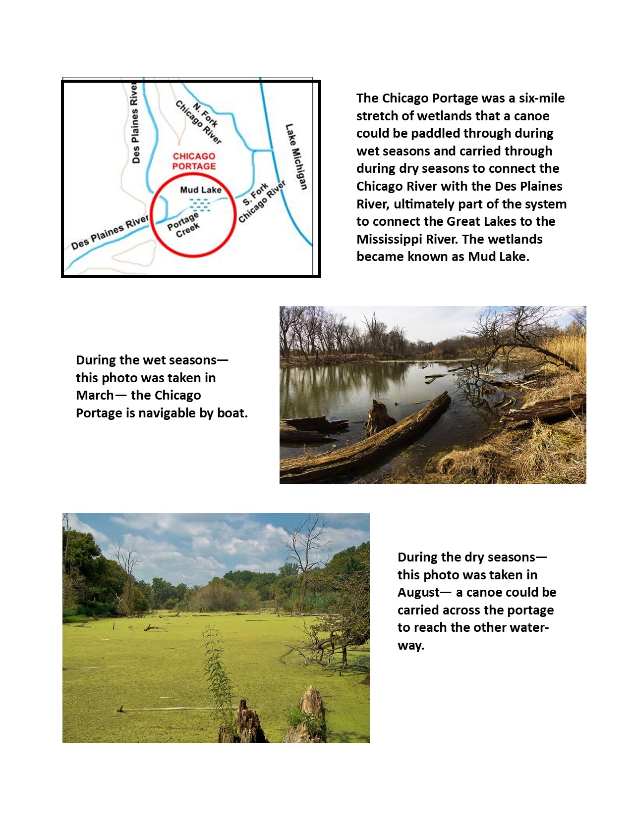
The second important purpose was its vital location for transportation and trade. The system of waterways and seasonal wetlands west of Lake Michigan offered portages between the Great Lakes and the Mississippi River to the west. This was vital in connecting the East Coast to the Midwest, and then the Mississippi ran south all the way to what we call the Gulf of Mexico.
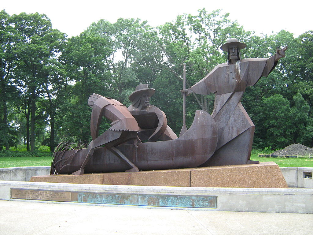
One of the most important early portages was the Chicago Portage.
Also, the Cal-Sag Channel was built to give a boost to other waterways in the system and that will be discussed further in a future post.
In today’s world of air travel, these systems may not seem so important. But in the past, when shipping ruled, long before there were even railroads, a route like the Chicago Portage or the Cal-Sag Channel was very critical.
Of course, the Native Americans knew about the Chicago Portage and used it for thousands of years, and were the ones who showed it to the European explorers. The idea that white settlers “discovered” the portage system is not accurate. They exploited the system shown to them by the Indigenous People to further settlement and development.
And it was a Native American who recommeded the building of the Cal-Sag Channel.
Many overland trails also passed through the area. Geographers have identified seven major trails that ran through the Calumet region, and many smaller trails have been lost to development. Some of the trails intersected right at the southern tip of the island, which is now where Western Avenue crosses the Cal-Sag Channel. Many of these trails developed into major roadways today.
The Calumet region was inhabited by multiple Native American groups, predominantly the Illinois and Miami, who were then replaced by the Sauk, Fox, and Kickapoo, and ultimately the Potawatomi established the dominant presence, and were the major inhabitants in the 1830s when the land was turned over to the U.S. government and the Indians left the area.
An important point to consider is the Native American concept of “land ownership” and we will discuss this in the next section, and begin to explore the life of the indigenous people of the Calumet region, which is incredibly complex and fascinating.
Native Americans and the Blue Island Ridge – Part 6More Wars and More Treaties
The War of 1812 saw the beginning of the end of the Native American presence in Chicago. After U.S. military and settlers were killed, and Fort Dearborn was burned down, by Potawatomi warriors in the Battle of Fort Dearborn, the U.S. government became determined to remove Indians from the area to allow further settlement to go on unimpeded. “Chicago” was strategically located for transportation and trade, and the land surrounding it was rich for farmland.
Fort Dearborn was rebuilt in 1816. In the Treaty of St. Louis signed in 1816, the Council of Three Fires (the Ojibwa, Odawa, and Potawatomi, although only the Potawatomi were living in the Chicago area) gave up all claims to a 20-mile strip of land that included the Chicago Portage connecting Lake Michigan to the Illinois River. The Chicago Sanitary and Ship Canal is on this land now.
“Indian boundary lines” which started at the lake and ran southwest were established on either side of this strip of land. The deal with the Indians was that white settlers were permitted to settle safely within the lines. The southern line ran just below the southern tip of the Blue Island Ridge, placing the lands of the Ridge communities, that is, today’s communities of Beverly Hills, Morgan Park, Washington Heights, and Mount Greenwood, and the City of Blue Island, within the settlers’ territory.
Although the “Illinois Territory” was first claimed for the developing U.S. during the Revolutionary War, this made it official that the Blue Island Ridge was under the control of the U.S. government, slated for settlement by U.S. citizens, and was no longer under the control of Native Americans.
In 1821, the first Treaty of Chicago was signed by the U.S. government and the Council of Three Fires. This affected the Chicago area because among the land turned over to the U.S. government was an easement between Detroit and Chicago around the southern coast of Lake Michigan.
The Black Hawk War occurred in 1832. Black Hawk, a leader of the Sauk people, led a group of Sauk, Fox and Kickapoo into the Illinois Territory from Iowa. Their motives were assumed to be hostile, and the U.S. military opened fire on a delegation of the group, inciting the “war.” Most of the Potawatomi people did their best to avoid the conflict. Some other tribes took sides for or against the U.S. The Native Americans were defeated.
One notable fact from the Black Hawk War was that Abraham Lincoln served in the U.S. military at this time, stationed in Wisconsin, but he never saw combat.
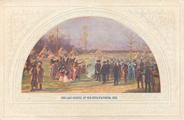
The Black Hawk War culminated in the 1833 Treaty of Chicago, in which the U.S. government took over total control of certain Native American lands west of Lake Michigan, including the Chicago area. The Potawatomi received promises of cash payments and tracts of land west of the Mississippi River.
In 1835, five-hundred Potawatomi warriors gathered in full dress and danced the last recorded war dance in the Chicago area. The majority of the Indians left the area after that. Chicago was incorporated as a city in 1837.
The purpose of these first six installments of this series was to give a very brief historical background as context for the history of Native Americans on the Ridge. We will now turn our attention to the Native Americans who lived on and around the Blue Island Ridge up to the 1830s.